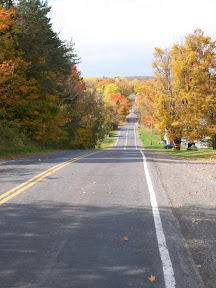
Wednesday, December 17, 2008

December Century Ride: N-S Double Loop, Fleming-Candor


The route
I did my first winter century ride of the season on Tuesday. December, January and February are the most challenging months for century rides because there are many fewer days that are good for all-day biking; plus, in December and January, the days are really short. In general when I'm planning a century ride, I check the weather reports for the next ten days, figure out which day is most likely to be good in terms of weather, and hope I can take that day off.

Checking ahead, this past Monday seemed like it would be great for an all-day ride: temps were to be in the 50s. Unfortunately I couldn't take that day off, but it ended up being warm but also raining.

So Tuesday was the day. It was supposed to be cold, in the 20s, but the roads were dry and it was partly sunny. So I took the day and rode.
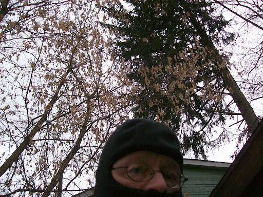
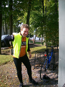
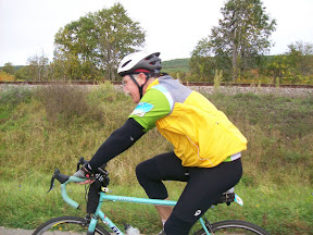
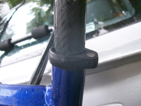
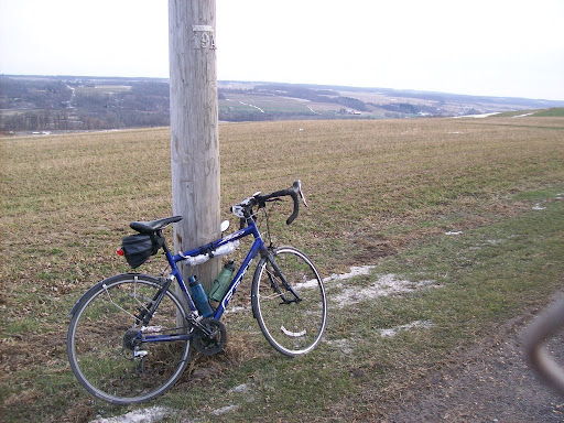

Part of the balaclava
The temperatures that day ranged from 22 to 30, so I dressed for the weather: on top, a merino wool base layer, a cotton turtle neck shirt, and my wind-proof and water-proof commuter biking jacket. On the bottom, merino wool base layer, biking shorts, and denim jeans. On top, a new fleece balaclava (just bought it at Target last weekend for $12) with breathable mesh over the mouth (this worked great, no glasses fogging!); and Visorgogs, which look a bit goofy, but do an excellent job keeping my eyes and upper face warm while not fogging up. On my feet (always my biggest challenge in winter riding) I wore cotton socks, two plastic shopping bags on each foot (for waterproofing), chemical hand warmers, then wool socks, and my regular biking shoes. This arrangement was a tight fit, but it actually kept my feet warm all day. (on edit: Forgot about my hands! I did wear gloves, my blaze orange fleece "Hot Shot" hunting gloves, they're great, with little grippers on thumbs and first two fingers.)

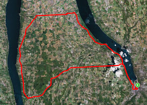
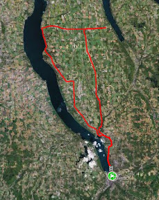
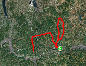
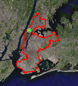
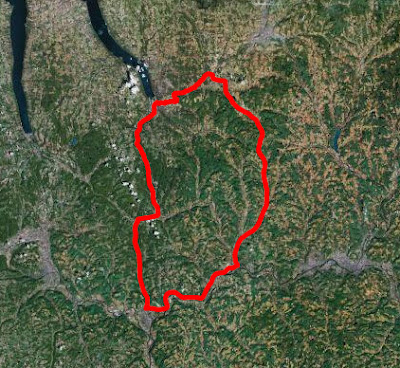
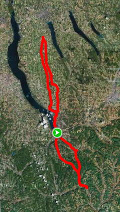
When the temperature is in the 20s, I usually arrange my century rides in loops that take me back home about half-way through the ride so I can warm up, change into dry and warm clothes, and eat. For this ride I plotted a north-south ride with two loops, first heading about 30 miles north to the town of Fleming, then back to Ithaca, then out about 20 miles to Candor and back.

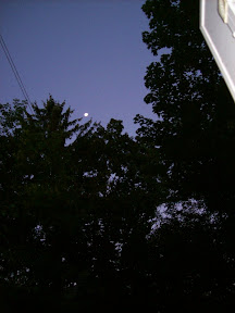
I started out at 8am, half an hour after sunrise, which gave me 8½ hours total time before sunset. When I left it was 22 degrees, and there was a stiff north wind. Fortunately the roads and shoulders were all dry.

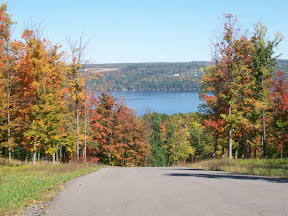
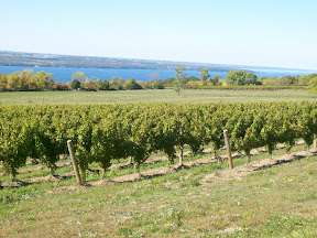
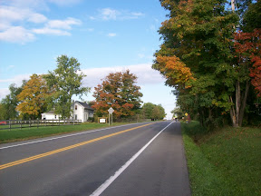
As I pedalled up Route 34 alongside Cayuga Lake, I could feel the wind, and knew that my northward ride was going to be slow.
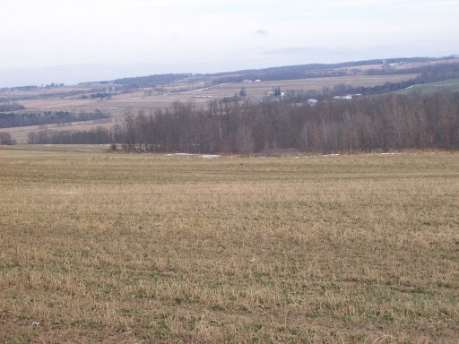
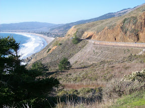
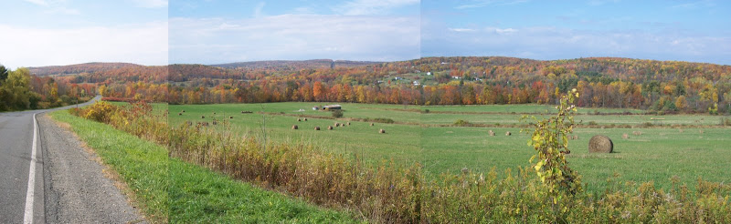
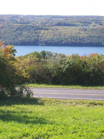
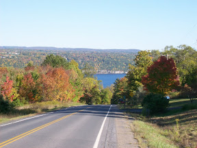
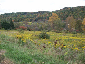
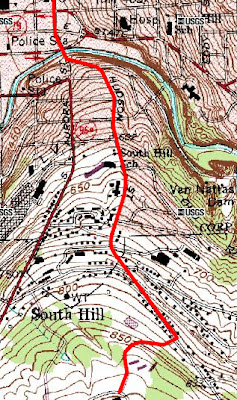
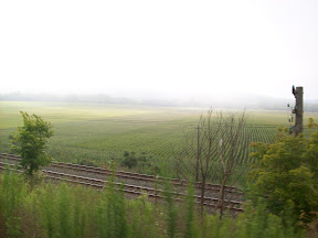
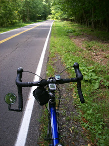

Looking east from Indian Field Rd
Ithaca to Lansing is about 7 miles, uphill climb of about 600 feet, but after that the ride is relatively flat - the remaining 23 miles had about 1000 feet of climbing. This part of the ride is entirely along state Rt 34, so I was riding on nice wide shoulders. It goes through mostly farmland, fields and dairy farms, and just before Genoa a very smelly and huge pig farm (which is much worse in the summer).

But I really felt the winds: they were 10-15 mph from the north pretty much the entire way. Then there are the huge trucks that just roar down 34, and it's amazing how much wind they generate, and when they're headed in the opposite direction, how much that really, suddenly, slows you down on a bike. I knew it would be really slow when I got to Genoa, at mile 18, and saw my average. Usually my average at Genoa is about 15-16 mph. On this ride, it was only 11.9.

I got to the Fleming-Scipio town line, at mile 30.51, at about 10:30. It had been slow going, so my average for the first 30 miles was only 12.38 mph.


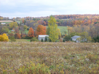
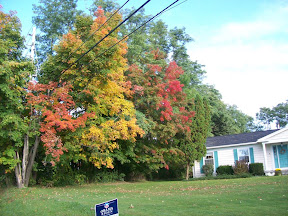
At the town line road, I stopped for some water, then turned around and headed back south. About a mile down the road I turned right onto Black Rd. Black Road is also called Indian Field Rd, and is a north-south road that runs along the top of a ridge, so has a great view, including of Rt 34 across a big valley. Indian Field Rd. goes through fields, by barns, a sheep and goat farm, a number of dairy farms. It's rolling for about the first half, but from Rt 90 southward it's pretty much downhill and flat until Ludlowville.

At the Lansing town line the road becomes Salmon Creek Rd, and runs alongside that creek. Salmon Creek Rd runs through forests as well, and ends up in the little hamlet of Ludlowville. There's a steep downhill to a metal deck bridge, and then an immediate climb up Brickyard Rd, left onto Rt 34b, then right onto 34 and back into town. My average on this leg of the ride was better, 16 mph.

The first 60 miles of the ride went well. Apart from the strong north wind, I felt good. I stayed warm, kept up a reasonable pace, and got home at about the time I'd planned, 12:30pm.

At home I stripped off my wet clothes, changed into dry clothes (same outfit as at the start), ate some soup and other stuff, drank water, juice and soy milk, and by 1:10 was off again, now headed south for the second, 40 mile loop.

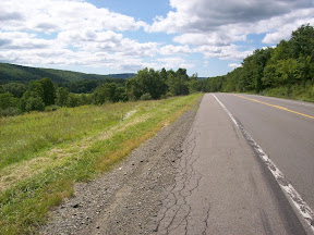
By this time, it had warmed up to about 29 degrees, and the wind had died down to a reasonable 5 mph. I climbed up South Hill along Rt 96b, which I followed all the way to Candor. This is a ride I'd done a few times before, the shoulder is nice and wide, and here too the roads and shoulder were dry. Interestingly, there was almost no snow on the ground on the northern part of my ride, but on this southern part, the ground and fields was still covered. Rt 96b from Ithaca to Danby is a climb of about 1000 feet over 10 miles. After Danby it's basically flat or downhill with a few rollers. I got to Candor, mile 80, at about 2:30, averaging 13.7 for that leg of the ride, which had an average climb over 20 miles of 57.4 ft/mile. The temperature had again fallen down to the mid-20s.

Stopping at Candor I saw that my water bottles had partially frozen, including about 1/2 inch at the very top. I used a key to chip a hole through the ice and managed to drink the unfrozen water. By the time I got home, all the water would be frozen along the sides of the bottles.

At Candor I turned around and headed back north along 96b. (BTW, as I was pedalling north, right near Mill St a car honked a few times at me, was that anyone out there?) I turned onto Wilseyville Rd and then onto Coddington Rd. Usually this is a ride into a strong headwind, but this time the wind wasn't too bad. Coddington is very flat, going through a kind of valley of farmland. I turned onto White Church Rd and headed towards Brooktondale. White Church is rolling, through farms and forest, very little traffic, and a steep downhill to Valley Rd, through Brooktondale, onto Brooktondale Rd, which is a flat couple of miles with an uphill to Rt 79. I then followed 79 back to Ithaca, this is flat to downhill, bringing you into downtown Ithaca.

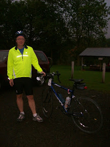
I got home at 4:15, 15 minutes to spare before sunset. I felt fine, my feet weren't frozen, I wasn't exhausted. This turned out to be a nice winter century ride.

This marked century number 17 for me for 2008. I'll be doing the century a month challenge again next year. I can hope for a 50 degree January day (like we had in 2008), but I now have my cold winter day century strategy down. All I have to hope for are a few days of dry roads. And not too much wind!

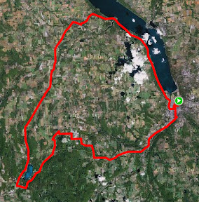
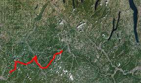
Route: Ithaca-Fleming-Ludlowville-Ithaca-Candor-Brooktondale-Ithaca
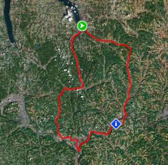
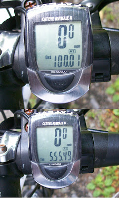
Total distance: 101.80 miles
Ride time: 07:15:03
Avg speed: 14.04 mph
Total climb: 4263 ft
Low point: 394 ft, Ithaca
High point:
1310 ft, Danby
Avg climb: 42.63 ft/mile

Sunday, November 23, 2008

Northern California ride!

Winter is taking its toll, and I've not been able to get out riding as much as I'd like. And when I do it's just not the same as those wonderful summer riding days. So when business brought me out to San Francisco, I decided to take an extra day and do some riding.

I went onto Mapmyride.com and checked out some likely routes in Marin County, just north of San Francisco, and when I got to SF I bought the excellent Marin Bicycle Map. I plotted a course that was about 80 miles, but with shorter options if I wasn't feeling up to it. I rented a road bike in SF (Giant OCR), and on Friday morning took off toward the Golden Gate Bridge.


Crossing the Golden Gate Bridge, 9am
The weather was perfect, in the 60s and sunny. I rode over to Sausalito and continued on the bike path north, turning westward at Sycamore Ave, winding through some residential streets to get to Sequoia Valley Rd and then the Panoramic Highway.

What amazing views on this route, Sequoia and the Panoramic Hwy! There's climbing, but it's pretty gradual, nothing more than a 8-9 percent grade. The Panoramic Highway goes around Muir Woods, the park with the huge ancient redwoods, and the road itself goes through heavily forested areas.

The road has no shoulder, but on Friday the traffic was pretty light. The only downside was that the road was being repaved and for maybe 2-3 miles of downhill I was riding on roadway that had been milled down and was thus very bumpy and grooved, so I took it real slow.


Looking north toward Stinson Beach from the Panoramic Highway
Finally the road work ended and I had a beautiful downhill into Stinson Beach. The views of the Pacific are spectactular. I turned north onto Shoreline Road (Route 1), and headed toward Port Reyes Station. The first part of this road is totally flat, right along the shore, and I cruised along at 19-20. Then the road turns away from the shore and becomes more rolling. It goes through a eucalyptus tree forest at one point, beautiful.


A flat bit of Rt 1 North of Stinson Beach
At Port Reyes Station I stopped at the Bovine Bakery, recommended to me by someone over at Bikeforums.net. I was feeling real good, the rental bike felt great, so I decided to try to make the ride into a century. To make sure I was back by dark I wanted the extra 20 miles to be as flat as possible, so I asked some cyclists who were at the bakery for suggestions, and they pointed me toward Bear Valley Rd all the way past Inverness where a big hill starts. So after I downed my pastry and bought some water and a banana at the grocery store across the street, I took off toward Olema.

I turned onto Bear Valley Rd. There are a couple of rollers at the start but it was really flat. After about 7 miles, just after the Inverness Inn, I hit the hill. I rode up it part of the way but decided to turn back when it looked to be pretty endless. I headed back, went through Olema and back onto 1.


Bovine Bakery in Point Reyes Station
After Stinson Beach Rt 1 began to climb, and the ride between Stinson Beach and Muir Beach is one of the most spectacular rides I've ever done. The highway is way up on the bluff overlooking the Pacific, and just to the right of the road are cliffs that go down 200-450 feet to the ocean. In some places there are guardrails, but in other there's nothing... Fortunately traffic was very light and so I was able to ride in the middle of the lane in those places. The road weaves inland along gullies and then back out to the shore, and the view is amazing.

Just past Muir Beach the road turns inland, and there's a great downhill. But in the middle of that downhill, I heard a loud pop and suddenly I realized my back tire had blown. When I got off the bike to check it out I saw that not only was the tube trashed, but the tire itself had a 5-6 inch rip in it. I called the place I'd rented from but they didn't seem to know where I was (I wasn't quite sure myself) and told me to call them back in 15 minutes.


Looking north on Shoreline Hwy between Stinson Beach and Muir Beach
Fortunately, the cyclists in that area were incredibly helpful. Everyone who went by stopped, and one guy, after I explained my situation, actually went down to the nearby Pelican Inn, and came back to tell me he'd found another cyclist who had a truck and could bring me to a bike shop in Sausalito, about 6-7 miles away. I got to the Inn and the guy (I never did get his name) loaded my bike into his truck and we headed to Sausalito.

I got to see the rest of Rt 1 to Sausalito from the passenger seat of the truck; it is beautiful, and I'm disappointed I didn't get to ride it. But I got to the bike shop, thanked my ride and said goodbye. Turns out that the rim was really messed up too, so the bike rental place drove out to Sausalito with a new wheel and tire so I could complete the ride. At this point, almost 2 hours after the bike broke down, it was getting close to sunset, so I realized I wouldn't be able to make my century.


San Francisco at sunset, from Golden Gate Bridge
I headed off toward San Francisco, crossing the Golden Gate at about sunset, with a beautiful view of San Francisco (the photo really doesn't do it justice), though lots of pedestrians slowed my last few miles. I got to the bike shop as dark descended.

I felt great, and ended up walking back to my hotel up Hyde St. The distance is only about 1.5 miles, but in the first 1/3 of a mile it climbs almost 300 feet, and the grade for much of that climb is upwards of 20 percent. My legs felt fine and I wasn't in the least bit winded. I realized I'm in better shape now than I was at age 25!

This was a fabulous ride. The weather was perfect, in the 60s and sunny, and such a nice change from the cold temps I've been biking in the past month. My legs felt great. The only downside is that the cyclometer that came with the bike only gave current speed and trip distance, so I had to keep track of time using the clock which only had minutes. So my speed is an estimate. Next time I'll bring one of my own cyclometers. And I'll rent from a real bike shop instead a place that just rents bikes to tourists...

The Finger Lakes region is beautiful, but Marin is beautiful in a whole different way. I'll definitely plan to come out this way again, even if only to do some riding!!
Route: San Francisco - Sausalito - Panoramic Highway - Stinson Beach - Point Reyes Station - Inverness - Muir Beach - [bike repair interruption] - Sausalito - San Francisco
Total distance: 88.33 miles
Ride time: about 5 hours, 54 minutes
Avg speed: about 14.9 mph
Total climb: about 4400 ft
Low point: 10 ft, San Francisco, Sausalito
High point:
1578 ft, on Panoramic Highway
Avg climb: 49.81 ft/mile

Wednesday, October 15, 2008

Hankering for hills


My Cayuta Lake loop: Cayuta Lake is the little lake in the lower left hand side of the photo. Connecticut Hill is the heavily forested area just east of Cayuta Lake
I like flat, smooth roads just as much as the next cyclist. I love to get going real fast, boosting my average speed and distance, and just cruising.

But sometimes I like to climb hills. I do the 530 feet climb on my commute to work in the morning, but this past week I wanted to do some good hill climbing, especially with the beautiful fall leaves.

So on Saturday I headed out and climbed up to Schaffer Rd in the Newfield back hills, stopped to pick apples with my wife (who drove up) at Little Tree Orchard, and continued on to Van Etten. The climb was great, as was the inevitable downhill. In the 6½ miles from where you turn onto Newfield Depot Rd from Rt 34, to the summit in North Van Etten, at 1845 feet, just north of the North Van Etten church, it's 1840 feet of climbing, for an average of 283 feet/mile.  The total climb for that ride was about 2400 feet, for an overall average of 55.6 ft/mile.


Panoramic view looking up Millard Hill Rd

Yesterday afternoon I again headed for the hills. I wanted to do my Cayuta Lake loop, but decided to take a hilly way to the lake, via Connecticut Hill -- the highest point in Tompkins County, at 2099 ft. Unfortunately the roads that go the highest are all dirt roads, and I don't like to ride dirt roads on my road bike, especially on downhills, so I skirted the hill, taking the paved roads around the hill. The highpoint on these paved roads is 1814 ft.


On Connecticut Hill Rd
The climb up from where Millard Hill Rd branches off from Rt 13 before Newfield is a beautiful one. Very little traffic, a relatively gradual climb up to the summit of 1814 ft, altogether over 6½ miles, 1840 feet of climbing -- an average of 283 feet/mile -- coincidentally exactly the same as Saturday's ride. The sun was out, it was windy, and as I got higher more and more trees had totally changed or else had already lost their leaves -- downtown there are still plenty of green leaves mixed with the reds and yellows and oranges.


Trumbulls Corners, from Millard Hill Rd
After all that climbing the rest of the ride, on Co.Rt 6 and 10, and then state routes 228 and 227 into Trumansburg, and 89 back into Ithaca, were all relatively flat and pretty easy (except for that one big climb on 89...).  The total climb on this ride was 2636 feet, and the average climb was 51.4 ft/mile.

All in all these were great rides, and if you like beautiful vistas and some moderate climbing, these are great roads to ride.

Wednesday, October 8, 2008

Between the lakes


Cayuga Lake from Rt 89 at Seneca/Tompkins Co. line
Monday after work I went out for a ride. It felt chilly, the wind felt cold and I felt tired. The season of warm rides in shorts and t-shirts is over. I was feeling a bit down.

I checked the weather forecast for the next day: it was supposed to be a beautiful day. So I decided I'd do one of my favorite rides, what I call Between the Lakes. On Tuesday I got up early, finished up most of my work by early afternoon, and got going.   By the time I left it was pretty warm out, sunny, a beautiful fall day.

The Between the Lakes ride takes me up to Interlaken along the west side of Cayuga Lake, over to Lodi, down along the east side of Seneca Lake, to Burdett, and than back across to just north of Ithaca.

The start of the ride is the gradual uphill along Rt 89 from Ithaca up to the Cayuga Lake Creamery ice cream place at Interlaken.  I love this stretch, there are only a few significant uphills, and there are a few nice downhills, including down into Taughannock.  The views of Cayuga Lake are spectacular as you ride along the west side of the lake out of Ithaca, and then again later from higher points.


Cayuga Lake Creamery, on Rt 89
at Interlaken

Coffee ice cream cone
Of course I stopped at the Cayuga Lake Creamery (only three more ice creams and I get a free one!!) and got a double scoop of coffee ice cream.  From there I continued a bit down Rt 89 and turned left onto Rt 141 towards the village of Interlaken.  This is a pretty gentle climb, about 240 feet over a little more than a mile.

In Interlaken I turned left onto Rt 96, and after a couple of blocks, right onto Rt 96a, which you follow for about five miles into the village of Lodi.  This stretch is a good climb, but again pretty gradual, climbing from about 910 feet to 1240 feet just before Lodi, through mostly cornfields.  The last mile and a half is a downhill of about 140 feet down into the village.

Seneca Lake from Rt 414, vineyards in foreground
In Lodi, I turned left onto Rt 414, which goes along the east side of Seneca Lake.  This is wine country, and I biked by numerous wineries, vineyards, and restaurants.  414 has a nice shoulder, and is newly paved for most of this stretch, so it's a pleasure to ride on.  Traffic wasn't heavy at all -- apparently on weekends it can get crazy with all the winery tourism -- and it's a gradual downhill, with only a few uphill rollers, going from about 1050 ft at Lodi to about 600 feet at Valois, about 7 miles down the road. South of Valois, there's a bit of a gradual climb, and then another gradual descent.  This is a beautiful stretch and not hard at all, despite the gradual rollers.  


Seneca Lake from Co.Rt.5
headed to Burdett
A few miles south of the village of Hector, I turned left, away from Seneca Lake, onto County Route 5 to head toward Burdett. I had made excellent time: my average speed at this point was 17.00 even with all the climbing.

County Rt 5, or Tug Hollow Rd, is the only real climb of the ride, going from 740 feet at Rt 414 to 1000 feet at Burdett, about 260 feet over a mile. Overall that's not bad, but one stretch is 110 feet climb over 460 feet of distance, which works out to be pretty steep.


Fall leaves in Perry City
At Burdett I sometimes stop at the Grist Mill, but I wanted to get home quickly, so I continued along Rt 79, which is somewhat rolling at this stretch. I continued onto Rt 227 (rather than following 79, which involves a very big climb and then lots of very big rollers), which takes you through Reynoldsville and then to Perry City.  From Perry City you continue straight on Perry City Rd, which is a gradual uphill, a couple of rollers up to Halseyville Rd, and then all downhill for about 4½ miles to Rt 89.  The view of Cayuga Lake on that last steep part of Perry City Rd as you approach 89 is spectacular.

The ride back into Ithaca on Rt 89 is pretty much downhill, along the lake, through Cass Park -- a bad stretch with no shoulder for a little bit, though the speed limit for cars is 30 there -- over the bridge, left onto State St and back into Ithaca.


Cayuga Lake from Perry City Rd
At about Burdett I started feeling tired.  I have to admit I hadn't eaten lunch, had only had oatmeal and a banana for breakfast. So all I had during the ride was the ice cream and my single bottle of water.  By the time I hit Burdett I was feeling hungry and very thirsty, and it really showed up in my legs.  On flats I was fine, but on inclines I felt real tired.  I was also pushing myself to make at least the same time I'd done this route in last time, in August, when I averaged 16.66mph. You'd think I'd know by now that I have to eat and drink regularly to have a comfortable ride...

By the time I got home I was totally wiped out. I haven't been that exhausted on a ride in a long time.  But I managed to improve my average, getting 16.75mph!

Overall this is a great ride. Between the Cayuga Lake Creamery and the Grist Mill in Burdett there are two great food stops on the route. The scenery is spectacular, the climbing is very reasonable and overall pretty gradual.  I'm hoping to do this route again sometime soon.


The route

Route: Between the Lakes: Ithaca - Interlaken - Lodi - Hector - Burdett - Perry City - Ithaca
Total distance: 64.65 miles
Ride time: 03:51:38
Avg speed: 16.75 mph
Total climb: 2900 ft
Low point: 394 ft, Ithaca
High point:
1260 ft, east of Lodi
Avg climb: 44.86 ft/mile

Sunday, October 5, 2008

Metric Century: Aurora - Ludlowville loop


The route (including a few miles
where we missed our turn)
Last weekend I rode part of the STBC century ride with karcod. Unfortunately my seatpost broke so I only made it to mile 85, and since I'd done a century the day before, I wasn't in my best form. And it was pouring rain.

So Karl suggested doing a ride this weekend, and I proposed a loop going north from Ithaca that includes some of my favorite roads.

We left at about 8:15am. It was still pretty chilly, about 39 degrees, but it was sunny, a beautiful fall day. We headed north up Route 34, one of the more gradual ways to get out of Ithaca.

At the stop light at Rogue's Harbor we turned left onto Rt 34b, and took the big downhill near the Lansing schools, then the long uphill out of that valley. A short while after we leveled out, I noticed my back wheel felt soft, I looked down and I had a flat. With Karl's help -- and the loan of a CO2 cartridge -- I was back on the bike and we were off towards Kings Ferry.


Leaves changing along 34b
The weather in the morning was great, perfect biking weather. It had warmed up so that we were pretty comfortable, it was sunny but cool, the leaves were changing, it was a great Finger Lakes fall day.

We continued through Kings Ferry, turning left onto Rt 90 and following it along, enjoying the big downhill into Aurora, enjoying the great view of Cayuga Lake. In Aurora we stopped at Dories for a pitstop. I had a muffin and orange juice and got a shot of karcod (below).

We continued along Rt 90 until Levanna, where we turned right on Levanna Rd. This is the one part of today's route that I had not yet ridden, and it turned out to be real nice. My usual route from Aurora to Indian Field Rd is Sherwood, just at the northern edge of Aurora, but to make it a metric century we needed to go further along 90. Levanna it turns out is a much more pleasant ride, not as much of a climb, more shaded, through forests rather than just along farm fields, and less traffic.


Karcod in Aurora
Unfortunately I was gabbing away and missed Indian Field Rd. I had a feeling we'd gone too far, so I asked some people and yes, we'd gone about 3 miles past Indian Field, in fact almost all the way to Rt 38 (the spur at the top right hand of the above map is that detour). We turned around and headed back, turning south on Indian Field Rd (also called Black St).

This is one of my favorite roads around here. Much of it is up on a ridge, and you can see the valley of Salmon Creek getting deeper and deeper; by Genoa it's a 220 foot descent down to the creek. It's also mostly downhill, some rollers but after crossing Rt 90 very much a descent.

At the Lansing line it turns into Salmon Creek Road, and goes along the creek, in the valley between two ridges. I really like this part of the ride, through this valley, it's real peaceful and pleasant at all times of year.


More fall leaves
Salmon Creek Rd ends up in Ludlowville, where we turned left. In Ludlowville there's a downhill, over a metal deck bridge, and then a left turn onto Brickyard Rd. Brickyard is a nice climb, starting at 460 feet and climbing pretty quickly up to 580 and finally up to 680 ft where it hits Rt 34b. I had actually sort of forgotten how steep it is at the start and when Karl asked me which ring to use, I said middle. Of course I quickly realized that wasn't right, so I shifted to the small ring and told him to do so as well. I guess he figured it out, he got to the top okay.

From there it's a another (gradual) 160 feet uphill to Rt 34, then pretty much all downhill into Ithaca. We got back at about 1:15.

This was a great ride. I enjoyed riding with karcod, who's a good riding companion, the weather was perfect, and I love these roads. I think karcod enjoyed them too, even with all the climbing. I told him the next ride we can do down in the flatlands around Candor.

Route: Ithaca-Lansing-Aurora-Levanna-Scipio-Ludlowville-Ithaca
Total distance: 69.10 miles
Ride time: 04:16:07
Avg speed: 16.19 mph
Total climb: 3292 ft
Low point: 394 ft, Ithaca
High point:
1329 ft, east of Scipio
Avg climb: 47.64 ft/mile

Tuesday, September 30, 2008

Back-to-back centuries -- almost

This past weekend I planned to do two centuries.

On Saturday, the Alfred Century ride, going from Almond to Olean and back, on the Bacchetta Giro 20 recumbent.

On Sunday, the Southern Tier Bike Club century picnic ride, a series of loops out of Owego that add up to 100 miles, on my Felt Z80 road bike. Unfortunately I didn't manage to finish that because of bike problems.

But first things first...

Alfred century route
Alfred century route, Almond to Olean and back (with Finger Lakes to show location)
Alfred Century ride

This ride is a fundraiser for the Alfred branch of Habitat for Humanity. The route follows the original route from 1895, going from Almond to Belmont to Cuba to just outside of Olean and back the same way -- I can't imagine riding those old high-rider bikes on what must have been unpaved roads. Must have taken them forever. In our case, we made pretty good time.

Since the start of the ride is a 2 hour drive from home, my biking buddy tommie -- who rode his Giro 20 aluminum frame with disk brakes -- and I drove out to Alfred the night before. We got up early on Saturday morning, drove into Hornell for breakfast -- french toast and fried eggs! -- and got to the Almond Town Hall for registration. By starting time, 8am, there were about 20 people, only four of them recumbents (the ride had been listed as "recumbent friendly").


Scenery along the route
The forecast had called for rain, and when we left our hotel room in the morning it was raining, but then it stopped, and the day turned out to be dry and very nice.

We'd been told that the total climb of the ride was 1000 feet, and over the first 7 miles a 400 feet climb. We quickly realized this was wrong. The start of the ride is a climb out of Almond from 1400 feet to 2100 feet, about 700 feet of climbing, though mostly gradual.

The ride was on good roads, very nice. The group gradually spread out, and Tommie and I were riding together. Then from behind us came hndlebar, who I'd met at a few other events. Tommie, hndlebar and I rode the rest of the route together.

A
hndlebar
I'd been riding the Giro 20 for about 2 weeks, and had put on about 150 miles. I had discovered that my 900 miles on the Rans Tailwind 'bent hadn't totally prepared me. The Giro's bottom bracket is higher than the Tailwind, and so it takes different muscles. My first rides were a lot slower, but by last week, when Tommie and I rode out to Burdett (48 miles rt) I was feeling better on the Giro.

On the Alfred ride the Giro felt great. It was still hard up hills, but on some hills I managed to use high cadence to maintain a decent speed. On flats, and into headwinds, the Giro was good. Overall I felt good, my legs lasted the entire time, no crashing or bonking at all. My final average speed was 15.9mph -- I was very happy with that.


STBC picnic ride: My 85 mile route
Southern Tier Bike Club century picnic

This ride started at Hickories Park in Owego, and was set up as a series of loops so people could decide how far to ride. The century ride was made up of three loops. I've ridden a number of STBC rides and have really enjoyed all of them, and the STBC folks are great people, so I was really looking forward to this. I was hoping that the century ride on a 'bent the day before wouldn't wipe me out, especially since it used different muscles. So I loaded up the bike and drove down to Owego on Sunday morning a little before 6am.

The forecast for the day was rain, and as I looked at the radar pictures I could see a huge swath of rain headed in our direction. So I packed extra clothes just in case.

It wasn't raining when I got to the park. But by 7:30am, just as we started to leave the park, the rain began, and turned into a real downpour.


Yours truly at the start of the day; rain not yet falling
The first loop of the ride, 48 miles, went up Rt 38 to Richford, turned west onto Rt 79, then turned south onto West Creek Rd, back to 38 and into Owego. This is a pretty flat course -- 800 or so feet of climbing. The ride up Rt 38 is a gradual uphill to Richford. I stopped at Richford, and others doing the loop did so as well. My speed on 38 was disappointing -- it was about the same average as when I have done this stretch as part of a century ride, but on those rides this is the last stretch, and here I hadn't climbed out of Ithaca and hadn't ridden 60 or 70 miles already. I think part of the reason was the ride the day before, which I guess did take something out of me, and part was that I hadn't eaten enough in the morning. So at Richford I chowed down. After refueling -- eggs and sausage pizza! -- and after seeing karcod zoom by up Rt 79, I started up again, and felt much better.


At Hickories Park
I'd never ridden the Rt 79 hill at Richford, though I'd driven it many times. Turns out it wasn't as bad as I feared it would be. West Creek Rd is a route I have ridden a few times, and I really like it. Very little traffic, through forests and by farms, overall a gentle downhill with only a couple of very small climbs. Turning left in Speedsville and continuing onward, I ran into Regina and Jim SAG-ing, headed the other direction. They told me that karcod was just a mile ahead, and Regina egged me on "Go! Go!" So I went. The pizza and other food had just kicked in, so I maintained a good pace 19-21mph on this stretch.

I didn't catch up with karcod, but I managed a great average for this loop, 17.2mph.

At the Park, I changed into dry clothes and a warmer more waterproof jacket, and drank and ate to refuel. Karcod suggested doing a longer version of Loop 2 so we wouldn't have to do a third loop at the end to reach 100 miles. The longer loop was one I'd done before and was very familiar with -- out to Candor on 96, over to Spencer (the official loop turned down Halsey Valley), continuing on to Van Etten, down 34 through Lockwood to Waverly, and back to Owego on 17c.

We left the park, headed out to Rt 96. We were lucky that the rain had let up, and it was no longer pouring, just drizzling. Karcod showed me a back way to get to 96, and fortunately the unpaved part of 96 just after the bridge was pretty minimal. We had a headwind headed north into Candor, not too bad. We continued on into Van Etten, up the hill, and then cruised down Rt 34 at a great pace.


My seat post: notice the crack on the right
I was feeling the need for some refueling, so we stopped at the convenience store in Lockwood, where I got pizza (of course), potato chips, peanuts, and drink. Karcod and I sat outside and finished up our refueling. As I was getting ready to leave, I unzipped my seat bag to put my phone and money back in, and I felt the seat move. I checked, and yes, the seat post -- carbon fiber -- was moving. Looking closer, I saw that the back half of the post was sheared almost half way through. I hadn't noticed any movement when I was riding, but this must have been developing over time. I had read about this kind of thing happening with carbon fiber seat posts and here it was in real life.

I decided not to ride any further -- I'd done about 85 miles. I'm really glad I discovered this at a stop, rather than having the seat post break while I was cruising along (I don't even want to think about what would have happened...)

Video of my broken seat post moving back and forth

I called Don to see if he could SAG me back, he was in Owego so it would be a 1/2 hour wait. I told karcod to get going, he was beginning to get chilled and there was no sense in him waiting with me. He resisted at first, but I insisted, so he took off. I waited about 30 minutes and Don showed up, put my bike on top of his car, and we drove back to Owego. We passed karcod on 17c at Halsey Valley Road.

I have to admit I was pretty disappointed at not being able to finish. I was feeling really good, and while my speed wasn't what it would have been if I'd not ridden 100 miles the day before, I was very happy with it, and I probably would have broken my previous century record of a 16.7mph average. As it turned out, my average for the entire 85 miles was 16.8mph.

At the park I changed into dry clothes and hung out. When Regina got back to the park from part of a loop, I took her up on her offer to try out her new T-Rex recumbent. I rode a loop of maybe 1/2 mile around the park, and boy did I feel those recumbent muscles. I don't think I could have ridden 100 miles (or 85) on a recumbent. But I felt great on the upright.

Despite the rain, and my disappointment at not being able to do a whole century, this was a great ride. I finally got to ride with the legendary karcod, and almost got to do back-to-back centuries. There's always tomorrow...

Route: Alfred Century Ride
Bike ridden: Bacchetta Giro 20 recumbent
Total distance
: 108.66 miles
Ride time: 06:49'43
Avg speed: 15.91 mph
Total climb: 3325 ft
Low point: 1342 ft, Almond at start of ride
High point: 2051 ft, outside of Almond

Avg climb: 30.6 ft/mile
Route: STBC Picnic ride
Bike ridden: Felt Z80 road bike
Total distance
: 85.06 miles
Ride time: 05:03'19
Avg speed: 16.83 mph
Total climb: 1701 ft
Low point: 820 ft, Owego
High point: 1385 ft, just west of Richford

Avg climb: 20.0 ft/mile 

Monday, September 22, 2008

Commuting up South Hill


Morning commute up South hill: 530 feet of climbing over 1.2 miles
For at least the past ten years I've been commuting to work in the morning up South Hill. The first mile or so of my ride, through downtown, is pretty flat, maybe 20 feet of climbing over about 3/4 of a mile. But then the climb begins.

The steepest part is at the start, heading up Aurora St and then turning onto Hudson. The maximum grade here is 13%. The average grade of the entire climb is about 6%.

I do this commute summer and winter. When it starts to get snowy and icy, I put on studded snow tires (Kenda Klondikes).

When I first started doing this commute I wasn't so comfortable biking in traffic, especially up this climb. When you're biking up a hill like this, you're going maybe 5-6mph, while traffic is going by at about 30mph. It took me a while to get comfortable with that.

Coming downhill is a breeze, no climbing at all, just a 530 foot descent. In fact, I have to use my brakes as I go by the elementary school -- a friend of mine got a ticket there for biking over the 15mph speed limit.


Uphill bike lane on Hudson
Also, up until last week, Hudson St was pretty treacherous. The downhill street was full of potholes, bumps and other paving obstacles that meant you really had to slow down.

But then, last week, they repaved Hudson St. It's great now. Smooth. Very smooth.

And they've added an uphill bike lane!

The city seems to be getting serious about encouraging biking. The city buses have had bike racks for quite a while now, and they're discussing putting uphill and downhill bike lanes on East State Street (Rt79), which is a relatively gentle climb out of downtown.

When I saw that Hudson was being repaved, I emailed the city employee who deals with bike lanes, and he confirmed their plans.


My commuting bike: 1992 Univega Activa Country Hybrid, with Arkel Dolphin 32 panniers
So I was happy to see the bike lane a reality this morning as I headed to work. I know that separate bike lanes are seen as controversial by some biking advocates, but on these uphill stretches, where there's no way you can bike at car traffic speed, they're important. I think they'll slow the cars, and give bike commuters some breathing space.

I didn't get into road biking until last summer, but what I found is that my morning commute really helped me; climbing 530 feet is a great workout, and now that I'm doing longer distances, I find that I can take the hills on most rides at a pretty good pace. Actually most of the time those hills are not as steep as my morning commute.

Of course the commute up South Hill is not as steep as some of the routes up East Hill. But I'll cover that in another blog post sometime.

Monday, September 8, 2008

NYC Century Tour: September Century #1


Headed down Broadway towards Times Square
On Sunday I did what was probably my favorite and most interesting century ride yet: the annual New York City Century Tour.

This is a 100 mile ride that takes you through Manhattan, Brooklyn, Queens and the Bronx. As their promo material rightly claims, you see the city in a way you've never seen it before.

I lived in NYC for 9 years in the '80s and early '90s, mostly in Manhattan, and loved it. But that entire time I didn't have a bike, so I'd never cycled in the city. On the other hand, I bike-commute here, so I'm used to riding in traffic -- not that traffic here is anything like in NYC, but riding in traffic instills certain habits that are very useful no matter where you are.

The ride started at 6am at Central Park North. I left the place I was staying, on E. 44th St near the UN, at about 5:15, biked over to Central Park South, and got onto East Drive in the Park. The road was totally empty, except for a few cyclists headed the same way. It was beautiful, still pretty dark, since the sun hadn't yet come up.

There was a big crowd at the start, but pretty well organized. I managed to meet up with a group from the Southern Tier Bike Club, including Regina on her new Rans Ti-Rex recumbent (titanium!!), Steve and Nancy, who I'd met at the Keuka Lake ride, and a few others -- easily found by the fuzzy balls sticking up out of their helmets. We started out in the early morning dawn, headed out on 110th St over the Riverside Dr, through my old neighborhood.

We cruised down Riverside Dr to 72nd, then cut over to Broadway and headed downtown, around Columbus Circle, through Times Square. It was very early Sunday morning, so there was little traffic, and the bikes dominated the streets. It was very cool.


Crossing the Brooklyn Bridge
We crossed the Brooklyn Bridge as the sun was coming up. We then headed into Brooklyn. Though I lived in Brooklyn for a couple of months, and had visited parts of it, I don't know it very well, and Queens and the Bronx are total unknowns to me. The ride took us through all kinds of neighborhoods in all those boroughs, as well as along bike paths through forested parks, bike lanes along the shore, along busy roads, over highways, alongside highways, over bridges. It was fantastic.

Overall the route was good. The roads were pretty good, the bike paths too. There were a few bike paths, especially in the Bronx, that were not so great, bumpy and not well maintained. The bridge crossings were also a bit of a challenge in places; the Triborough Bridge crossing includes a number of places where there are steps, so you have to carry your bike up and down in those places. There's also a stairway at the end of the ramp, leading to the street, that isn't obvious. Some places in the Bronx were also roughly paved, or gravel. But overall, the route was great and very bike-able.


A Brooklyn beach, taken from somewhere along the Shore Parkway
It was cool to ride as part of such a large group too. After the start, people spread out, and there would be clumps of people biking together, some of them together because they knew each other, others just because they happened to be together at that time in the ride. In a few places, the markings on the road were hard to see, so I missed some turns. The good thing is that others did too, and so we bushwhacked through together, with the help of some cyclists who knew the areas, and got back on track. A few times I was by myself, but just ahead I could see another group, which I joined for the next part of the ride.

The rest stops were about 15-20 miles apart, just the right distance, and they provided just what I needed. Lots of apples, bananas, orange slices, and even plums. Pita bread and hummus! That was a treat. Also sports drinks, and of course water, as well as bagels with pbj, and Krispy Kreme doughnuts. I'd had lasagna and my wife's leftover penne for dinner the night before, topped off with a couple poptarts and fig newtons, so I was well loaded up on carbs. For breakfast I'd had juice and a bagel with cream cheese. And I really chowed down at each of the rest stops. I felt great by the end.


Crossing the Triborough Bridge, headed to the Bronx
My energy level was really good. I did great on the hills (not that there were any major ones on this ride...), pretty much passing everyone else -- there are some advantages to living at the bottom of a gorge!

Of course, since we were mostly riding in traffic and on streets -- none were closed off, the entire ride was in "real time" -- we had to stop for traffic, at least slow down for red lights and stop signs, and deal with the traffic which in a few places was heavy. (Or at least I stopped at red lights when there was cross traffic, not everyone did, but the day before in Brooklyn we'd come upon a horrible scene, the aftermath of an accident where an 8 yr old had been hit and killed while riding his bike with his dad. That kind of thing makes you much more careful when you ride in traffic...)

Anyway, riding in traffic really cut down on my average speed -- which ended up being 14.71 (as compared to 16.89 for my last century, which had about the same amount of climbing as this one) -- but it was well worth it. The one segment where I did the best was between Prospect Park and the Canarsie Pier; a very large part of that was along the shore, on a bike path that was well paved, wide and very very flat. The rest was on roads with little traffic. On that section I averaged 18 mph.

As for the climbing, this seemed to be a very flat century. My altimeter measured about 2830 feet of climbing, about the same as the last century ride I did, but it seemed like it was flatter, and looking at topographical maps I think that overstates it. In any event, relatively, it seemed like a very flat course, and it definitely avoided some of the climbing that it could have covered, in northern Manhattan, for example.

All in all, this was an amazing ride. If you love biking in urban areas, love NYC, or just want to have a great time, this is the ride to do.


The route
Route: Manhattan - Brooklyn - Queens - Bronx
Total distance: 100.95 miles
Ride time: 06:51'53
Avg speed: 14.71 mph
Total climb: 2831 ft (this might be overstated... altimeter was a bit off I think)
Low point: 0 ft, along Brooklyn waterfront
High point: 167 ft, near Ridgewood Reservoir, Brooklyn

Avg climb: 28.04 ft/mile (maybe less)

Thursday, August 28, 2008

July century ride No. 1: My first 'bent century!

So in July I managed to do three rides of 100 miles or more. The first and third were about 100 miles each; the second one was a 150 miles, a century and a half. This post will be about the first century ride, I'll post later on the other century and on the century and a half rides.


The Rans Tailwind I rode (Tommie's new Bacchetta Giro in background)
My buddy Tommie, who got me into road cycling last summer, rides a recumbent. He'd had a Rans Tailwind for years, but this summer decided to upgrade. We made the trek to Alfred, NY, to the Bicycle Man store, which specializes in recumbents and lets you take them all out for a spin. I tried a bunch along with Tommie. He ended up buying a Bacchetta Giro, a very cool bike. And that meant that his Tailwind was now free for me to ride. So I started going out with him riding the 'bent.

Riding a 'bent is different than riding a road bike. It's definitely more comfortable. But it also takes different muscles than an upright. I'd ridden the 'bent a couple of hundred miles and was enjoying it, so I thought it would be fun to do a century ride on the 'bent with Tommie.

I picked a route that covered roads I'd ridden before, south of here, a route that was overall pretty flat. But I wanted to avoid Rt 17c west of Owego, so I plotted a route on the other side of the Susquehanna.

We left and headed east on Rt 79. I don't think I'll do that again, the traffic out of Ithaca in the morning, especially the big trucks, was pretty awful. Anyway, we got out of town and continued on 79 all the way past Caroline, and turned right onto West Creek Rd. This is a nice pretty quiet road that is relatively flat, a few rollers, and it brings you all the way down to Rt 38 just north of Owego. I decided to take Back West Creek Rd, which has almost no traffic, but is a bit hillier than West Creek, and unfortunately is gravel at a couple of points. We then headed into Owego, where we stopped at the pizza place on Lake St., then at a store to get a rain poncho for Tommie, since it had started to drizzle.

After eating a bit, we crossed the bridge over the Susquehanna and turned right onto Southside Drive, and then turned onto Sulphur Springs Rd. This turned out to be more of a climb than I thought -- 300 feet over about 1/2 mile or so -- and remember, 'bents aren't as good on climbs as road bikes. We made it no problem. It's really a beautiful road, hardly any traffic, through forested area. We turned onto Smith Creek Rd and followed that to the end. This was a rolling road, through forests and fields, very nice. The problem came at the end. The maps, both online and paper, showed this road going all the way through to River Rd. But it actually dead-ended at a huge warehouse, with a road going around it. We turned left, hoping to find a way to River Rd, but nothing seemed to go there, and the road was quickly headed uphill. So I stopped and asked some people; turns out they rerouted the road, and we should have turned right at the end of Smith Creek Rd. So we headed back, went around the warehouse, and found River Rd.

We biked along River Rd, and met up with our friend Denny -- on a 'bent, of course -- in Nichols. We rode with Denny through Athens, up to Sayre, along the bike route on River Rd, right alongside the Susquehanna, then at Chemung onto Rotary Rd and up onto Wyncoop Creek Rd. This is a great ride, rolling and headed uphill from Chemung, but quiet and nice. Denny rode with us part of the way then headed back. We continued on to Van Etten, climbing to the crest of the hill, then a big downhill. From Van Etten, to Spencer, back to Ithaca on Rt 34/96.

Overall this was a fun ride. It was slower than my other centuries -- I haven't yet developed my "bent legs" -- but definitely more comfortable! There was also more climbing that I'd planned, almost 3600 feet, rather than the 2700 or so I was hoping for. But I'm planning another bent century in September.


The route
Route: Ithaca - Owego (via 79 & West Crk Rd) - Sayre - Van Etten - Ithaca
Total distance: 105.92 miles
Ride time: 07:59'17
Avg speed: 13.26 mph
Total climb: 3576 ft
Low point: 390 ft, Ithaca
High point: 1348 ft, on Wyncoop Creek Rd outside of Van Etten

Avg climb: 33.76 ft/mile

Thursday, August 21, 2008

Another August Century Ride: 100 miles in under 6 hours


100 miles in under 6 hours
When I told my friend Denny my average speed for the 150 mile ride I did a month ago -- in particular the speed of the last 100 miles (15.8 mph), he said, "you'll be doing a century in under 6 hours soon!" And that got me thinking. My third century ride in July (not yet posted) I managed to do 100 miles in 6 hours, 6 minutes and 35 seconds! So I decided to to a modified version of that same route that was a bit flatter.

I got up very early in the morning, and left home at 6:15am. That is technically sunrise, but because we're surrounded by hills the sun hadn't quite showed up yet. It was also colder than I thought it would be, about 44 degrees. In fact the first two hours of the ride ended up being in the 40s. Fortunately I'd sort of planned ahead, and wore a short sleeve t-shirt under a long-sleeved t-shirt. That kept me warm enough, but wasn't too hot when the weather warmed up.


The morning sky at 6:15am
So I left home at 6:15, and headed south on Rt 34/96 to Spencer, about 18 miles away. Much of the ride was through heavy fog and mist, so I stopped and turned on my blinkies. By the time I reached Spencer, the sun was up, but it was still chilly. I stopped at the pizza place, which was open at 7:30 in the morning, with pizza! And it was a good pizza, topped with scrambled eggs and sausage. After a slice of that washed down by some fizzy lemonade, I hopped back on the bike and headed towards Van Etten, then turned south toward Waverly.

There's a short climb out of Van Etten on Rt 34, but then it's amazingly flat (very slightly inclined downhill) from Van Etten to Waverly. The route has very light traffic and a nice shoulder, and much of it runs alongside Cayuta or Shepherd's Creek. It was very cold though, since the road is just west of a very big embankment for much of the way.

By the time I got to Waverly, about 8:50am, it had warmed up to 50 degrees, but it was still overcast from high fog. I headed east on Route 17c, peddling away. I was optimistic about my time: at Waverly it was 16.3mph (to come in under 6 hours I'd have to have an overall average of at least 16.67), and the July ride with more climbing and a similar route had me at 16.0 at Waverly.


Fog and mist along Rt 17c between Waverly and Owego
I pumped away along Route 17c, and it finally cleared up and the sun was out by the time I reached Owego at 10am. I got there just as my favorite Owego pizza place (on Lake St) opened up, but they didn't have any pizza yet. Since I'd eaten two eggs and toast before I left, and had the pizza in Spencer, I gambled that I had enough in me to take me to the ice cream stand in Richford. So I downed a bottle of Vitamin Water and headed north.

As I was leaving Owego, right where Routes 96 and 38 meet there is major construction, and a long line of traffic. I went up to the front, but still had to wait about 15 minutes before we were signalled through. Fortunately most of the traffic turned onto Rt 96, as I headed north on Route 38, whose pavement had been totally torn up so that I was riding on packed dirt in a very narrow lane. That went for about 1/4 mile before the road was back to normal.


Route 38 between Owego and Harford, looking back south
There was -- as there always does seem to be on this stretch -- a significant headwind, but I hunched down and peddled away. Other than the headwinds this is a really nice part of the route, the shoulder is wide, the traffic is very low, and the scenery is beautiful.

I got to Richford, where there's a great ice cream stand, and checked my time. 16.8mph!! My goal was within reach. But... The route from Richford to Dryden was inclined uphill, with rolling hills. To make sure I had enough energy, I had my usual large milk shake and lemonade and also had some french fries with salt -- they were really good.

After finishing those off and resting a bit, I hit the road, and made it to Dryden in good time. I stopped there for some fig newtons and poptarts and another Vitamin Water, and then took off for the last leg.


The place I hit 100 miles: Forest Home Drive
I continued on Rt 38, which turns west in Dryden and then goes by the George Junior Republic and into the village of Freeville. In Freeville, I turned onto Rt 366, which is very flat; I turned onto Upper Creek Rd just before the bridge over Fall Creek. This road is slightly rolling, has a few turns, but has little traffic and runs right alongside Fall Creek, turning into Lower Creek Rd at one point. It then turns into Hanshaw Rd.

At this point I was watching the distance, and I figured I'd hit 100 miles after Varna. And in fact, I did. I turned onto Freese Rd, did the big downhill there and across the metal deck bridge, up the little hill to Rt 366 in Varna, turned right and pedalled down the hill turning right onto Forest Home Drive. And it was on Forest Home Drive, in one of my very favorite biking spots, that the trip distance hit 100 miles. I checked the time: 5 hours, 55 minutes, 49 seconds. I had done it.

The rest of the ride home was quick, another 3 miles or so all flat or downhill. My overall average was 16.89. I was secretly hoping for 17; maybe next time...

On edit 8/22: after analyzing time/distance/speed for each segment of the trip, I averaged a bit more than 17.6mph for all of the distance from Spencer to Owego, and then from Dryden to Ithaca (which, to be fair, has a lot of downhill). The Ithaca-Spencer section I averaged 15.28mph (climb averaged 53 ft/mile), which was actually slower than this part of my last July century (the other sections are all significantly faster); I'm thinking the fog slowed me down, since my glasses got fogged up too. The segment from Owego to Richford averaged 16.96 mph (as opposed to 16.46mph last time), my guess is a combination of the construction, not having eaten more in Owego, and the headwinds; and the average from Richford to Dryden was 16.70 (as opposed to 15.95mph last time). What I learn is that if I were to do a century ride with an average climb of about 22 ft/mile, and if I ate more sooner, I'd be able to break the 17mph mark.


The route
Route: Ithaca - Van Etten - Waverly - Owego - Dryden - Freeville - Ithaca
Total distance: 103.09 miles
Ride time: 6:06'13
Avg speed: 16.89 mph
Total climb: 2880 ft
Low point: 390 ft, Ithaca
High point: 1289 ft, on Rt 38 between Harford and Dryden

Avg climb: 27.94 ft/mile
Consumed: Lots of water, one lemonade, one slice scrambled eggs and sausage pizza, two bottles Vitamin Water, two pop tarts, two fig newtons, four chewy granola bars.