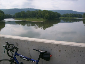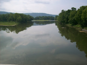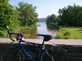
Taughannock Creek, looking towards the lake For my third July century I chose a route that was a big loop around Cayuga, Owasco and Skaneateles Lakes, and included a lot of roads I hadn't ridden before. The morning was beautiful, sunny, no rain predicted all day, a bit of a breeze.
The first stretch, up Rt 89 to Cayuga Lake Creamery at Interlaken, is one I've ridden a lot, of course. I got to the Creamery at about 10am, and even though they "officially" don't open until 11, as long as someone is there they will serve you. So I got a nice big coffee milk shake.
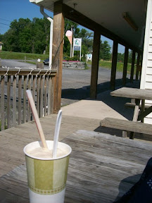
Coffee milkshake at Cayuga Lake
CreameryI continued up Rt 89. Now, I've ridden 89 from north to south a number of times, but as I rode this stretch, I realized I hadn't ridden south to north past Sheldrake. So this was a new experience. And I have to say, Rt 89 going north is a delightful ride.
There are some hills, but the balance going in that direction is downhill, until the flats at the northern part of the lake, where it's flat! Then onto River Rd, right along the lake, past lake cottages, and finally that last climb up to Rt 20. I loved that ride and will definitely do it that way again!
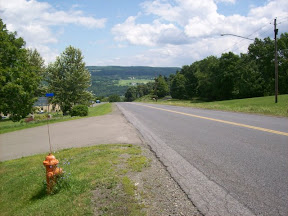
From Rt 20 I crossed over the Cayuga Inlet and turned right onto River Rd, passing along this small road that goes by the locks between the lake and the inlet, and the small cottages that line it. Then onto Rt 90, into the little village of Cayuga. By this time it was very hot!
I turned left onto Genesee St, which takes you right into Auburn. I decided to try this road, which I've never ridden or driven before, instead of riding the busy Rt 20. And it's a nice alternative. It's not as flat as 20, but the hills aren't big ones and there's not much traffic. It brings you right into downtown Auburn, and then as you follow it Genesee St eventually rejoins 20.
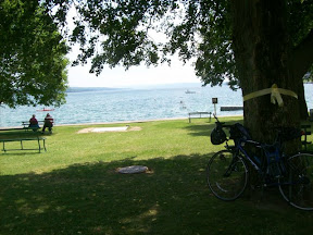
Downtown Skaneateles, at the north end of the lake The stretch of 20 from Auburn to Skaneateles is hilly, with some big rollers. The shoulder is nice, and traffic wasn't too bad, but it involved not just rollers but an overall climb.
At Skaneateles I stopped for lunch at a deli downtown, right across from the lake: a ham and cheese sub, chips and lots of liquid. I took it outside and sat in the shade of a tree in the park at the top of the lake, enjoying the breeze. Skaneateles is a busy place in the summer, there were lots of tourists wandering the streets, going out in boats, and the restaurants were all pretty full.
After a bit of a rest I got back in the saddle and headed out of town, turning onto Rt 41, which goes along the eastern shore of the lake. I had ridden part of 41 before, and knew it involved climbing. Overall the climb is from about 870 feet in Skaneateles to the high point of 1750 in Spafford, about 11 miles south of the village, with lots of rollers in between. It was a beautiful ride though. What's striking is how high and steep the hills are on the west side of the lake. As you head south they get bigger and steeper.
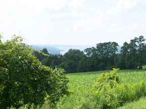
Skaneateles Lake, from Rt 41 at ScottEventually Rt 41 starts to head downhill. By Scott it's down to 1400 feet, and then by the time it hits Rt 281 in Homer you're at 1130 feet. I stopped at the convenience store/ gas station at the corner of Rt 90 and 281 and loaded up on liquid. It was a very hot day: my shirt, shorts and gloves were decorated with white patterns from the salt, and I was sweating a lot.
Then the final stretch. Rt 281 through Cortlandville is flat, okay shoulder even though there's traffic. Then the turn onto Luker Rd -- which also avoids all the construction on 281 -- and then onto McLean Rd, which turns into Fall Creek Rd and Rt 361. This stretch has some hills, though compared to other options of getting back to Ithaca is relatively flat. The shoulder is okay, except for a mile or two before Freeville, where there's no shoulder.
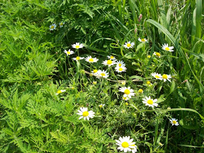
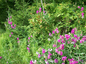
Wildflowers along Rt 41As I was riding along, a car pulled over ahead of me, as I got closer, I saw it was my friend and neighbor Michael, driving back from Syracuse, who was surprised to see me. A bit further along, all traffic was stopped for one of those huge houses on a truck, they were trying to back the house into a lot near a lake, and at least finally got the house off of the road.
The ride back into Ithaca was fine, Upper Creek and Lower Creek roads, meandering and dipping a bit up and down along Fall Creek, then across Rt 13, onto Hanshaw Road - which really needs a serious repaving - and down Devon Rd to Lake St and back into Fall Creek.
My legs were feeling tired on the stretch after Skaneateles, I think the heat was getting to me. But from Homer onwards I felt really pretty good, and when I got home I felt fine.
This is century number 3 for July, number 9 for the year: halfway to my goal of 18 centuries this year...
After a bit of a rest I got back in the saddle and headed out of town, turning onto Rt 41, which goes along the eastern shore of the lake. I had ridden part of 41 before, and knew it involved climbing. Overall the climb is from about 870 feet in Skaneateles to the high point of 1750 in Spafford, about 11 miles south of the village, with lots of rollers in between. It was a beautiful ride though. What's striking is how high and steep the hills are on the west side of the lake. As you head south they get bigger and steeper.
Skaneateles Lake, from Rt 41 at ScottEventually Rt 41 starts to head downhill. By Scott it's down to 1400 feet, and then by the time it hits Rt 281 in Homer you're at 1130 feet. I stopped at the convenience store/ gas station at the corner of Rt 90 and 281 and loaded up on liquid. It was a very hot day: my shirt, shorts and gloves were decorated with white patterns from the salt, and I was sweating a lot.
Then the final stretch. Rt 281 through Cortlandville is flat, okay shoulder even though there's traffic. Then the turn onto Luker Rd -- which also avoids all the construction on 281 -- and then onto McLean Rd, which turns into Fall Creek Rd and Rt 361. This stretch has some hills, though compared to other options of getting back to Ithaca is relatively flat. The shoulder is okay, except for a mile or two before Freeville, where there's no shoulder.
Wildflowers along Rt 41As I was riding along, a car pulled over ahead of me, as I got closer, I saw it was my friend and neighbor Michael, driving back from Syracuse, who was surprised to see me. A bit further along, all traffic was stopped for one of those huge houses on a truck, they were trying to back the house into a lot near a lake, and at least finally got the house off of the road.
The ride back into Ithaca was fine, Upper Creek and Lower Creek roads, meandering and dipping a bit up and down along Fall Creek, then across Rt 13, onto Hanshaw Road - which really needs a serious repaving - and down Devon Rd to Lake St and back into Fall Creek.
My legs were feeling tired on the stretch after Skaneateles, I think the heat was getting to me. But from Homer onwards I felt really pretty good, and when I got home I felt fine.
This is century number 3 for July, number 9 for the year: halfway to my goal of 18 centuries this year...
View Larger Map
Route: Ithaca - Auburn - Skaneateles - Homer - Ithaca
Total distance: 114.90 miles
Ride time: 07:26:59
Avg speed: 15.42 mph
Total climb: 4,332 ft
Low point: 394 ft, Ithaca
High point: 1752 ft, on Rt 41 south of Skaneateles
Avg climb: 37.70 ft/mile
Total distance: 114.90 miles
Ride time: 07:26:59
Avg speed: 15.42 mph
Total climb: 4,332 ft
Low point: 394 ft, Ithaca
High point: 1752 ft, on Rt 41 south of Skaneateles
Avg climb: 37.70 ft/mile