Thursday, September 23, 2010

Tour de Shunk Century ride 9/19/10

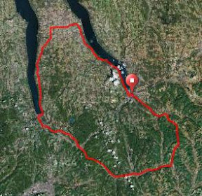
Route: Tour de Shunk Century Ride (Franklindale, PA)
Total distance: 105.01 miles
Ride time: 06:36:43
Avg speed: 15.88 mph
Total climb: 6,143 ft
Low point: 738 ft, at Proctor Rd near mile 50, along
High point: 2299 ft, Rt 154, Wheelerville Mountain
Avg climb: 58.5 ft/mile

Elevation profile(Elevation Profile)
Doug
Doug coming up a hill
My friends Denny and Jim did this ride last year, and it sounded great: 100 miles through the Endless Mountains region of Northern PA, with one monster climb and some other nice climbs. So I decided to do it. In the past month I've tried to do some big climbs to get ready, and my commutes up South Hill also helped.

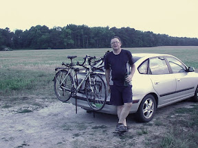
The ride starts at Rocky's Bike Shop, where I met Denny, Jim and Doug. We took off just before 8am. Unfortunately about 6 miles out Denny's back derailleur failed in a pretty spectacular way, fortunately no injuries, but he had to stop riding; he said he'd try to meet us when he got the bike fixed, so we continued on.

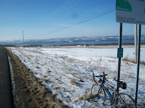
The course includes some pretty flat parts, along state highways, as well as some rolling hills and big climbs. The biggest climb came at about mile 19 or so, as route 154 goes up Wheelerville Mountain. I'd been expecting a monster climb with grades of upwards of 18-20 percent over three miles or so.

The actual climb wasn't that bad. It was a real challenge, over about 4-5 miles, especially the first 3 miles, constant grades of 10-12 percent. I had actually expected worse, and was expecting a huge gradient increase just around every corner, but it didn't come, and I actually felt great the whole ride up.

Jim
Jim at the end of one of the climbs


There were a few other challenging uphills after that, some really nice smooth downhills, some rollers, and some flats too. Overall it's a beautiful ride, almost all through forested areas, along creeks, some farmland. The road markings were great, and the rest stops every 25 miles or so were really good: bananas, cookies, drinks, and at the 50 mile stop sandwiches and chips too.

Denny joined us at the last rest stop, and the last leg was a pretty fast one, with a group of about 15 hammering along. I was feeling great, staying in the big ring for the rollers including the uphills, and feeling strong, getting out front. But then at one point, around mile 99 or so, my recovery rate plummetted, and it suddenly took a lot longer to get back to speed, so I fell behind the group a bit. I was still doing a good 20-21mph and felt fine, but that last bit of Rt 414 back to Rocky's, which is flat, saw the larger group (which included Denny and Jim), speed off.

When I finished, I felt really good. This was the fastest century I've done so far this year, even with all the climbing. (Which really means I've had a slow year...)

The ride ended with a real nice spaghetti dinner at Rocky's, so Jim, Denny, Doug and I piled our plates with pasta and sauce and chowed down. It felt great. I topped it off with some cookies and chocolate, then drove back to Ithaca.

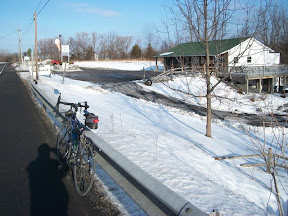
The weather really cooperated this time; no rain, overcast and in the 60s, a bit cool at the start, warmed up as the day went on, but not too hot, just right for those big climbs.

This is an event I'll definitely add to my annual century calendar!

Tuesday, September 14, 2010

NYC Century Tour

Route: New York City Century Tour (Manhattan - Brooklyn - Queens - Bronx
Total distance: 100.14 miles
Ride time: 07:27:43
Avg speed: 13.42 mph
Total climb: 2,525 ft
Low point: 0 feet (sea level), various places along route
High point: 322 ft, near Cloverdale Blvd, Queens
Avg climb: 25.2 ft/mile

(Elevation Profile)

W 110th St
Cyclists heading west on W 110th between
B'way and Riverside

I did this century ride a couple years ago, and really enjoyed it. This year, Lucas did it with me. It's pretty flat -- 2500 feet over 100 miles, so very doable.

The ride is mostly on the streets, starting at Central Park North and going down through Manhattan, over the Brooklyn Bridge to Prospect Park, down to Coney Island, then on the bike path along the shore, up into Queens, past Laguardia, across the Triboro (RFK) Bridge into the Bronx, up to Van Cortland Park and then back into Manhattan.

It's a great ride, you really do see parts of the city that you'd never see otherwise. For Lucas, who'd really only visited Manhattan before, it was also an interesting look at the other parts of the city.

The ride was very well organized, markings on the streets were great with just a couple of exceptions. And given how many turns were involved, quite an accomplishment. The rest stops were also great, lots of food -- bananas, really good apples, peanut butter, pita, bread, drinks, energy bars, plenty to keep you fueled.

On the Brookyn BridgeThe starts were staggered, we got out at about 6:30 or so, we rode by our friend Della's apartment on 110th St (which happened to be on the century route), and there were Lisa and Della, up on the 7th floor, waving to us. Then we turned down Riverside Drive and rode onward.

The riders soon ended up in clumps of between 5 and 20, and we rode along with clumps, or jumped up to the next clump. There was lots of stopping and slowing down for red lights and stop signs, so not a lot of nonstop pumping, with the exception of bike paths along the shore.

The ride was mostly flat, but a few small hills in Queens. A few of the hills involved bridges, including the RFK/Triboro, where we had to carry our bikes up and down a few steps, but those bridges also gave you great views.

Veteran's Bridge
Cyclists heading up onto the Cross Bay Veterans
Bridge in Brooklyn
I was really impressed with how well Lucas did. He hadn't ridden much this summer, but he kept on going the whole time, hammering along on the flats and on the hills.

The weather held off, the predicted rain didn't show up until the very end, in the Bronx. As we approached Van Cortlandt Park Lucas said he was having saddle-related pain. Since it was only about 10 miles to the end of the ride at Central Park North, and only about 4 more miles until we hit 100 miles, I asked if he could continue on, but he said no, even though his legs felt fine, the saddle pain was too much. He was happy with the 96 miles he'd done, the longest he's ridden so far. Which meant he really was in serious pain.

Astoria Park
Astoria Park rest stop; RFK/Triboro Bridge
in background
So we stopped at that rest stop, and called Lisa to come pick us up. Since I had only 4 miles until 100, Lucas said he didn't mind if I went out and rode a loop, which I did, following the century route until it hit Broadway, then coming back down Broadway. Century accomplished.

This is a really great century ride, unlike any other I've ever done and pretty unique. We liked it MUCH better than the 5 Boros Tour (in May), which is very much bigger, only 40 miles, and just way overcrowded. This one is a very nice size, excellent support, and riding through the streets and along the waterways of NYC is just a very cool experience.


Saturday, August 21, 2010

August Century: My 50th century ride

Route: Ithaca - Alpine - Breesport - Elmira Heights - Harris Hill - Elmira - Erin - Newfield - Ithaca (Ithaca Soaring route)
Total distance: 103.01 miles
Ride time: 08:01:30
Avg speed: 12.84 mph
Total climb: 7,834 ft
Low point: 394 ft, Ithaca
High point: 1871 ft, Van Kirk Rd @Irish Hill Rd, south of Newfield
Avg climb: 76.1 ft/mile
Rt 327
Climbing Rt 327
It was a perfect day for a bike ride, sunny, temps in the 60s-70s, and I had just the route picked out: the Rochester Bike Club's "Ithaca Soaring" with almost 8000 feet of climbing. Since I'm hoping to do the Tour de Shunk next month I thought I'd get in a climbing century. Plus this would be the 50th century I've ridden, so I wanted to do something memorable.

I'd done part of this route last fall, when I did the 65 mile version. I've been wanting to do the full century route, and I realized this was the right day to do it.

The route itself is great, almost all back roads, very little traffic, amazing climbs and downhills.

Rt 327
Trumbull Corners
I managed to get going at 8am, heading out along Spencer Street then Rt 13, turning off onto Rt 327 for the climb to upper Treman Park, then turning onto Trumbull Corners Rd, which turns into Sebring and brings you out onto Rt 13 north of Alpine. The route then goes along 13 to the convenience store at Alpine, where I stopped for a break. Then back to Smith Rd, to 224, then turning on Varney Hill Rd, the first real steep climb, not too long though. The route then continues until a left on Jackson Creek Rd, unpaved the first few hundred feet. This brings you into Breesport.

Just past Breesport I noticed my front tire was very soft - a flat. The tire itself has over 5,000 miles on it, and yes I've been meaning to replace it but it seemed to be doing fine... When I took it off and checked, there was a tiny hole through the tire. I used my handy supply of Tyvek, taken from old floppy disk sleeves, a bit of electrical tape to secure it, and then patched the inner tube, and I was ready to roll.
Rt 327

From Breesport the route continues onto Latta Brook Rd, then into Elmira Heights. I got there around noon, so stopped for pizza lunch. The route then heads uphill, down a bit along Halderman Hollow Rd, then up Hill Rd, Northcrest and Harris Hill Rd, leading into Harris Hill Park. It's a very forested route, mostly shaded so while it's climbing it's not in the sun.

As I was peddling along, I heard a small plane engine. Looking up, I saw a very small prop plane pulling a long white glider. At one point, the plane unleashed and turned back. The glider kept going, very gently, until I couldn't really see it anymore.

Rt 327
Gliders on Soaring Hill

Harris Hill Park has rides, minigolf, and an ice cream and snack bar. I decided to continue up to Soaring Hill and hit the food stand on my way back. The view along Harris Hill Rd right as you get to Soaring Hill Dr. is amazing, it's way up, and you get a great view of the river and hills.

Rt 327
Along Park Station Rd
I turned toward the air field, where a bunch of gliders were parked across from the National Soaring Museum. As I got there, a plane with glider was taking off. Then I headed back down, stopping for lemonade and ice cream.

The ride down into Elmira was great, almost 1000 feet of downhill to Water Street, following that over Rt 17 to the start of Jerusalem Hill, another nice climb. That turns into Breesport Rd, then a turn onto Federal Rd into Erin, where I again stopped. By this time it was pretty warm, I was very thirsty and running low on water. I bought five 20-oz containers of water, gatoraid and vitamin water to get me through the rest of the ride, since there was nothing else between Erin and Newfield.

Rt 327
On top of Austin Hill
After Erin, taking Laurel Hill Rd, around Park Station, a reservoir with a beach, through forests, then up Austin Hill, a nice climb, and down Austin Hill, a very nice downhill, followed by an even nicer, very long downhill on Rt 223. Fortunately there was no car traffic at all so I rode in the lane the entire way down, it was great.

The last bit, Rt 224 onto Jackson Hollow which turns into Van Kirk all the way into Newfield, was a lot of climbs and some nice downhills. At Newfield, the route goes along Main St, but the bridge was out, so I took Rt 13, which added 100 feet to the route. But then you get that very long, very nice downhill into Ithaca, with amazing views.

Rt 327
Along Jackson Hollow Rd
Overall this is an excellent route. Almost all of it is very low-traffic roads, mostly through forests. The climbs are nice, nothing too steep -- I think 15 percent was the steepest -- and while there are some long-ish climbs they are about 8-10 percent grade. And a couple of the downhills are really amazing.

This was the 50th century ride I've done, and it was a nice one. I'll be doing this ride again sometime for sure.


Thursday, July 29, 2010

Ride to Virginia July 11-16, 2010

At the end of the ride, mile 105 on day 6, mile 510 of the trip


I blogged about my 6 day ride from Ithaca down to the tip of Virginia's eastern shore at my touring blog.

It was a great ride, including 3 days of 100+ miles, lots of hot and humid weather, great cycling rodes and trails, a few broken spokes, and fried chicken.

Check it out.

Sunday, January 17, 2010

January century


On Rt 89 at Cayuga Lake Creamery
Finally, a day with dry roads and sunshine! And on a Saturday! I decided not to do one of my quick century routes, rather I cobbled together some roads I liked, and added in a couple new ones to bring the ride up to 100 miles. I also included a few nice climbs. I hadn't really ridden regularly since November, so I knew this would be slow and I took it easy. It turned out to be my slowest century on my road bike.

I started up Rt 89 towards Interlaken, past the Cayuga Lake Creamery (not open this early!) past my normal cut-over to Interlaken. To make the route 100 miles I had to go further north, cutting over to Rt 414 on Morgan Rd, Potter Rd, then Wyckoff. I'd never ridden these roads, but they were really nice, a great alternative to my regular route (Co. Rt 141 then 96a). These are quiet county roads, no traffic, a bit hilly with some climbing but very pleasant.


On Rt 414 south of Lodi, Seneca Lake in
background
Then onto Rt 414 which I followed down along the eastern shore of Seneca Lake into Watkins Glen. The vineyards are all covered with snow, and the view is great. I stopped at Hector Falls, which were frozen, and got a few photos. Then, into Watkins Glen where I stopped at Subway for lunch.

My time was pretty slow, and I wasn't feeling real strong, but I kept on going, into Montour Falls, turning onto 224 towards Odessa, and up that big hill, climbing about 350 feet over the first mile, steady, about 7-8 percent grade. Then, following 224 through Odessa, Alpine and into Van Etten. It was a beautiful ride, with the big hills covered with leafless trees and snow, the creek alongside, and it was relatively warm, in the lower 40s.


Hector Falls, on Rt 414
From Van Etten to Candor it's very flat, and I picked up my pace somewhat. But by mile 85 or so I was feeling tired, like I wanted to take nap. I kept on, through Candor, then up Honeypot Rd, another very nice climb, total of 1150 over about 6 miles, including some 10-15 percent grades. The rest of the ride was pretty much downhill, Old 76 to Central Chapel, to Valley, through Brooktondale and then back into Ithaca on 79.

I have to say this ride was not only my slowest road bike century, it also wiped me out more than any century I've done in a long time. I think it's a combination of lugging an extra 10 pounds or so of holiday weight gain, plus not having really ridden (other than commutes) for about two months, plus maybe the cold. It all added up.

The day was beautiful though, and I loved the route, I'll do this one again sometime. I am now just hoping for more dry-road days than we've had in the last month so I'm in better shape for my February century.

The route

The climbs

Route: Ithaca - Ovid - Watkins Glen - Van Etten - Candor - Brooktondale - Ithaca
Total distance: 103.07 miles
Ride time: 07:39:11
Avg speed: 13.47 mph
Total climb: 4,831 ft
Low point: 394 ft, Ithaca
High point: 1750 ft, on Honeypot Road, south of Caroline Center
Avg climb: 46.9 ft/mile