Thursday, August 28, 2008

July century ride No. 1: My first 'bent century!

So in July I managed to do three rides of 100 miles or more. The first and third were about 100 miles each; the second one was a 150 miles, a century and a half. This post will be about the first century ride, I'll post later on the other century and on the century and a half rides.


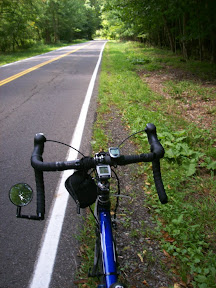
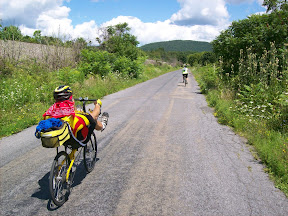
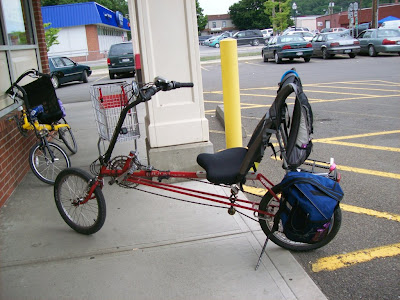
The Rans Tailwind I rode (Tommie's new Bacchetta Giro in background)
My buddy Tommie, who got me into road cycling last summer, rides a recumbent. He'd had a Rans Tailwind for years, but this summer decided to upgrade. We made the trek to Alfred, NY, to the Bicycle Man store, which specializes in recumbents and lets you take them all out for a spin. I tried a bunch along with Tommie. He ended up buying a Bacchetta Giro, a very cool bike. And that meant that his Tailwind was now free for me to ride. So I started going out with him riding the 'bent.

Riding a 'bent is different than riding a road bike. It's definitely more comfortable. But it also takes different muscles than an upright. I'd ridden the 'bent a couple of hundred miles and was enjoying it, so I thought it would be fun to do a century ride on the 'bent with Tommie.

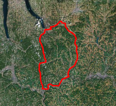
I picked a route that covered roads I'd ridden before, south of here, a route that was overall pretty flat. But I wanted to avoid Rt 17c west of Owego, so I plotted a route on the other side of the Susquehanna.

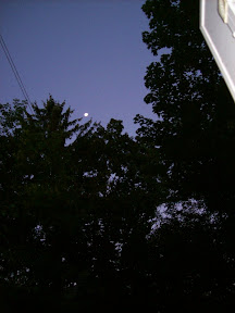
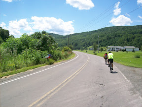
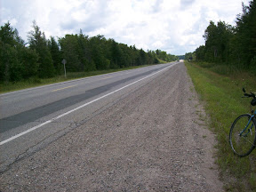
We left and headed east on Rt 79. I don't think I'll do that again, the traffic out of Ithaca in the morning, especially the big trucks, was pretty awful. Anyway, we got out of town and continued on 79 all the way past Caroline, and turned right onto West Creek Rd. This is a nice pretty quiet road that is relatively flat, a few rollers, and it brings you all the way down to Rt 38 just north of Owego. I decided to take Back West Creek Rd, which has almost no traffic, but is a bit hillier than West Creek, and unfortunately is gravel at a couple of points. We then headed into Owego, where we stopped at the pizza place on Lake St., then at a store to get a rain poncho for Tommie, since it had started to drizzle.

After eating a bit, we crossed the bridge over the Susquehanna and turned right onto Southside Drive, and then turned onto Sulphur Springs Rd. This turned out to be more of a climb than I thought -- 300 feet over about 1/2 mile or so -- and remember, 'bents aren't as good on climbs as road bikes. We made it no problem. It's really a beautiful road, hardly any traffic, through forested area. We turned onto Smith Creek Rd and followed that to the end. This was a rolling road, through forests and fields, very nice. The problem came at the end. The maps, both online and paper, showed this road going all the way through to River Rd. But it actually dead-ended at a huge warehouse, with a road going around it. We turned left, hoping to find a way to River Rd, but nothing seemed to go there, and the road was quickly headed uphill. So I stopped and asked some people; turns out they rerouted the road, and we should have turned right at the end of Smith Creek Rd. So we headed back, went around the warehouse, and found River Rd.

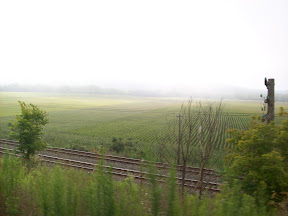
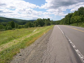
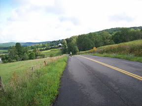
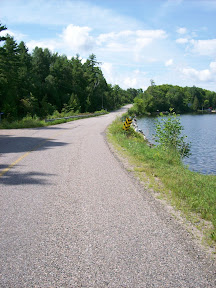
We biked along River Rd, and met up with our friend Denny -- on a 'bent, of course -- in Nichols. We rode with Denny through Athens, up to Sayre, along the bike route on River Rd, right alongside the Susquehanna, then at Chemung onto Rotary Rd and up onto Wyncoop Creek Rd. This is a great ride, rolling and headed uphill from Chemung, but quiet and nice. Denny rode with us part of the way then headed back. We continued on to Van Etten, climbing to the crest of the hill, then a big downhill. From Van Etten, to Spencer, back to Ithaca on Rt 34/96.

Overall this was a fun ride. It was slower than my other centuries -- I haven't yet developed my "bent legs" -- but definitely more comfortable! There was also more climbing that I'd planned, almost 3600 feet, rather than the 2700 or so I was hoping for. But I'm planning another bent century in September.
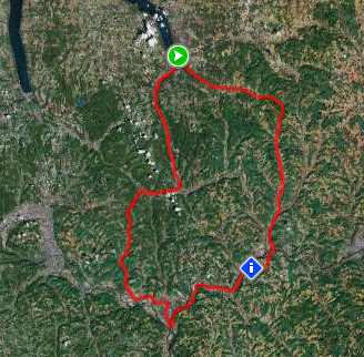
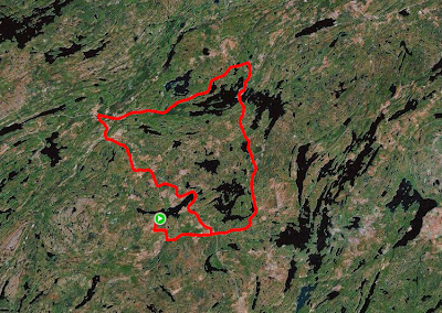

The route
Route: Ithaca - Owego (via 79 & West Crk Rd) - Sayre - Van Etten - Ithaca
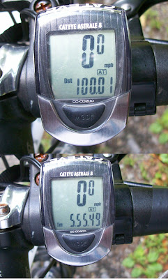
Total distance: 105.92 miles
Ride time: 07:59'17
Avg speed: 13.26 mph
Total climb: 3576 ft
Low point: 390 ft, Ithaca
High point: 1348 ft, on Wyncoop Creek Rd outside of Van Etten

Avg climb: 33.76 ft/mile

Thursday, August 21, 2008

Another August Century Ride: 100 miles in under 6 hours


100 miles in under 6 hours
When I told my friend Denny my average speed for the 150 mile ride I did a month ago -- in particular the speed of the last 100 miles (15.8 mph), he said, "you'll be doing a century in under 6 hours soon!" And that got me thinking. My third century ride in July (not yet posted) I managed to do 100 miles in 6 hours, 6 minutes and 35 seconds! So I decided to to a modified version of that same route that was a bit flatter.

I got up very early in the morning, and left home at 6:15am. That is technically sunrise, but because we're surrounded by hills the sun hadn't quite showed up yet. It was also colder than I thought it would be, about 44 degrees. In fact the first two hours of the ride ended up being in the 40s. Fortunately I'd sort of planned ahead, and wore a short sleeve t-shirt under a long-sleeved t-shirt. That kept me warm enough, but wasn't too hot when the weather warmed up.


The morning sky at 6:15am
So I left home at 6:15, and headed south on Rt 34/96 to Spencer, about 18 miles away. Much of the ride was through heavy fog and mist, so I stopped and turned on my blinkies. By the time I reached Spencer, the sun was up, but it was still chilly. I stopped at the pizza place, which was open at 7:30 in the morning, with pizza! And it was a good pizza, topped with scrambled eggs and sausage. After a slice of that washed down by some fizzy lemonade, I hopped back on the bike and headed towards Van Etten, then turned south toward Waverly.

There's a short climb out of Van Etten on Rt 34, but then it's amazingly flat (very slightly inclined downhill) from Van Etten to Waverly. The route has very light traffic and a nice shoulder, and much of it runs alongside Cayuta or Shepherd's Creek. It was very cold though, since the road is just west of a very big embankment for much of the way.

By the time I got to Waverly, about 8:50am, it had warmed up to 50 degrees, but it was still overcast from high fog. I headed east on Route 17c, peddling away. I was optimistic about my time: at Waverly it was 16.3mph (to come in under 6 hours I'd have to have an overall average of at least 16.67), and the July ride with more climbing and a similar route had me at 16.0 at Waverly.


Fog and mist along Rt 17c between Waverly and Owego
I pumped away along Route 17c, and it finally cleared up and the sun was out by the time I reached Owego at 10am. I got there just as my favorite Owego pizza place (on Lake St) opened up, but they didn't have any pizza yet. Since I'd eaten two eggs and toast before I left, and had the pizza in Spencer, I gambled that I had enough in me to take me to the ice cream stand in Richford. So I downed a bottle of Vitamin Water and headed north.

As I was leaving Owego, right where Routes 96 and 38 meet there is major construction, and a long line of traffic. I went up to the front, but still had to wait about 15 minutes before we were signalled through. Fortunately most of the traffic turned onto Rt 96, as I headed north on Route 38, whose pavement had been totally torn up so that I was riding on packed dirt in a very narrow lane. That went for about 1/4 mile before the road was back to normal.


Route 38 between Owego and Harford, looking back south
There was -- as there always does seem to be on this stretch -- a significant headwind, but I hunched down and peddled away. Other than the headwinds this is a really nice part of the route, the shoulder is wide, the traffic is very low, and the scenery is beautiful.

I got to Richford, where there's a great ice cream stand, and checked my time. 16.8mph!! My goal was within reach. But... The route from Richford to Dryden was inclined uphill, with rolling hills. To make sure I had enough energy, I had my usual large milk shake and lemonade and also had some french fries with salt -- they were really good.

After finishing those off and resting a bit, I hit the road, and made it to Dryden in good time. I stopped there for some fig newtons and poptarts and another Vitamin Water, and then took off for the last leg.


The place I hit 100 miles: Forest Home Drive
I continued on Rt 38, which turns west in Dryden and then goes by the George Junior Republic and into the village of Freeville. In Freeville, I turned onto Rt 366, which is very flat; I turned onto Upper Creek Rd just before the bridge over Fall Creek. This road is slightly rolling, has a few turns, but has little traffic and runs right alongside Fall Creek, turning into Lower Creek Rd at one point. It then turns into Hanshaw Rd.

At this point I was watching the distance, and I figured I'd hit 100 miles after Varna. And in fact, I did. I turned onto Freese Rd, did the big downhill there and across the metal deck bridge, up the little hill to Rt 366 in Varna, turned right and pedalled down the hill turning right onto Forest Home Drive. And it was on Forest Home Drive, in one of my very favorite biking spots, that the trip distance hit 100 miles. I checked the time: 5 hours, 55 minutes, 49 seconds. I had done it.

The rest of the ride home was quick, another 3 miles or so all flat or downhill. My overall average was 16.89. I was secretly hoping for 17; maybe next time...

On edit 8/22: after analyzing time/distance/speed for each segment of the trip, I averaged a bit more than 17.6mph for all of the distance from Spencer to Owego, and then from Dryden to Ithaca (which, to be fair, has a lot of downhill). The Ithaca-Spencer section I averaged 15.28mph (climb averaged 53 ft/mile), which was actually slower than this part of my last July century (the other sections are all significantly faster); I'm thinking the fog slowed me down, since my glasses got fogged up too. The segment from Owego to Richford averaged 16.96 mph (as opposed to 16.46mph last time), my guess is a combination of the construction, not having eaten more in Owego, and the headwinds; and the average from Richford to Dryden was 16.70 (as opposed to 15.95mph last time). What I learn is that if I were to do a century ride with an average climb of about 22 ft/mile, and if I ate more sooner, I'd be able to break the 17mph mark.


The route
Route: Ithaca - Van Etten - Waverly - Owego - Dryden - Freeville - Ithaca
Total distance: 103.09 miles
Ride time: 6:06'13
Avg speed: 16.89 mph
Total climb: 2880 ft
Low point: 390 ft, Ithaca
High point: 1289 ft, on Rt 38 between Harford and Dryden

Avg climb: 27.94 ft/mile
Consumed: Lots of water, one lemonade, one slice scrambled eggs and sausage pizza, two bottles Vitamin Water, two pop tarts, two fig newtons, four chewy granola bars.

Friday, August 15, 2008

Bike Tioga Century - August 2008


The route: "Crazy 8 Century"
Every August the Tioga County Tourism Office sponsors a weekend of riding in Tioga County, in the southern tier of upstate New York. This event -- Bike Tioga -- was held last weekend. There are various ride options ranging from 25 miles up to a 106 mile century ride.

I got up early last Saturday and made the 30 mile drive to Owego. It was still pretty foggy much of the way there, but by the time I got to the Hickories park a couple of miles east of downtown Owego, it had cleared, and I saw it was going to be a beautiful day.

And it was. The weather was perfect. The roads were great too.

I rode with Denny, who was on his Giro recumbent as usual; Jim, who I'd ridden with before on the Keuka Lake ride; and Tony. Turns out this was the first century ride for Jim and Tony -- they did great. And these guys were great riding partners.


Coming up Dean Creek Rd.
Anyway, the route was really nice. We started out at 7:30am, going north on Rt 96 out of Owego up to Candor and then over to Spencer, where we turned on Sabin Road to get to Dean Creek Rd. Dean Creek is a really nice ride, going south it's a gradual uphill, no big climbs, just a couple of small ones. It winds through very picturesque farm country, and there's very little traffic.

At the end of Dean Creek Rd we turned onto Rt 34 and headed down to Waverly, where we turned westward. We took River Rd, which I've described before, a nice little road/bike path that goes right along the Susquehanna, and then onto 17C. We turned north onto Lowman-Greatsinger Rd which eventually turns into Breesport-Chemung Rd. Again, this was a really nice ride, very little traffic, nice road going through farmland and forests. There were rolling hills but nothing major.


Riding along Wyncoop Creek Rd
At Breesport we turned onto Rt 223, then onto Fairview, and Marsh, and eventually ended up on Wyncoop Creek Rd. I'd ridden this road going south to north, which is a gradual, rolling uphill climb. For this ride, we got to do Wyncoop going downhill. There were still some climbs, since it is rolling, but overall it was a nice long downhill. Again, little traffic, very nice scenery. We stopped at the Farmland Animal Park on Wyncoop, where I got a large soft ice cream cone -- and when they say large they mean it, it was one foot tall, no exaggeration!


Riding along River Rd, headed back to Owego
From there we continued on down to Rt 17C, back onto River Road headed east, and then back onto 17C, which we followed back into Owego and on to Hickories Park. At the end of the ride, the Bike Tioga folks provided cold drinks, bananas and apples, pizza, and massages by professional massage people.

This was a really nice ride, and I'll definitely be doing it again next year. I'm also planning on riding some of those roads again sometime sooner.

Route: Bike Tioga "Crazy 8" Century Ride: Owego-Spencer-Waverly-Breesport-Waverly-Owego
Total distance: 107.62 miles
Ride time: 06:47:17
Avg speed: 15.85 mph
Total climb: 3091 ft
Low point: 780, River Rd along the Susquehanna west of Waverly
High point:
1486 ft, on Marsh Rd, E of Breesport
Avg climb: 28.72 ft/mile
Consumed: During the ride: Lots of water, gatorades, 2 bananas, slice of pizza, two pop tarts, small bag of salted peanuts, large soft ice cream cone. After the ride: a few cold drinks, a few slices of pizza, a banana, some chips.

Sunday, August 10, 2008

Biking in eastern Ontario

sunset from our cottageEvery summer, for a week in early August, my wife, kids and I pack up the car, strap on the canoe and bikes, and head up to eastern Ontario, where we rent a cabin (or as they call them up there, a "cottage") on a beautiful lake. It's rustic -- no electricity, plumbing or running water, but incredibly peaceful. We've been going up there for about 12 years now.

Since the road from our cottage to the main road is loose dirt and gravel, and since there are a lot of unpaved roads in the area, I bring my hybrid -- 1992 Univega Activa Country -- which at home I use pretty much only for commuting and doing errands around town. It has 700x38 tires though, which work well with unpaved roads.

My bike at Long LakeThis year I managed to get out for three rides. Two of them were to the nearby (15 miles away) village of Sharbot Lake, where there's a grocery store. I brought my Arkel Dolphin panniers and loaded them up with groceries. The third trip was a 44 mile loop through Long Lake, Mountain Grove, along the Transcanadian Highway -- Route 7 -- down Rt 38 through Sharbot Lake and back (see satellite photo of the route below).

The riding there isn't bad. That part of eastern Ontario is, in biking terms, similar to the Finger Lakes -- rolling hills, though nothing as steep as some of the climbs around here. The roads don't have the kind of shoulders you find in NY State though. The highways I've ridden have small shoulders. The 38 has about a foot and a half, which, given the low traffic, is plenty.

Shoulder of Rt 7, Transcanada Highway, between Mountain Grove and Rt 38The Transcanada Highway, Route 7, has a paved shoulder of about 2 feet in some places, in others (between the 38 and Perth, for example) there's no paved shoulder at all! The route I rode does have the paved shoulder (see photo at right), which was a bit smaller than I'd like, given the traffic -- not very heavy, but some big trucks -- and its speed -- 80-100km/hr (50-65mph).

Last summer I rode some routes that were mostly unpaved, dirt and gravel. These are beautiful rides, lots of very rolling hills, not very high but steep. This year, apart from the 2 miles between our cottage and the paved road, I kept to paved routes.

The other similarity to upstate NY, this summer at least, was the rain. It's been raining a lot, and while we were pretty lucky in that it was sunny most of the time, my last ride brought me through three separate downpours. Though I'd thought ahead and brought my rain jacket, I still got soaking wet.

Long Lake Rd at Long LakeAnyway, the route I rode took my from the village of Parham north along Long Lake road, which runs at one point along the eastern edge of that lake, where there's a public beach, and then further north to the village of Mountain Grove. The road has no shoulder, but has very little traffic, so it's a nice ride. The terrain is rolling, no big uphills but a number of shorter climbs. From Mountain Grove, I took Mt Grove Rd up to Rt 7. Route 7, as described above, does have a small paved shoulder and a big unpaved, gravel shoulder (see photo above). There were a number of small stands selling blueberries and pies; I bought a pint of blueberries from an old guy who reminisced about riding his one-speed bike up and down the hills of the area.

It was about 10 miles on the 7 until I hit Rt 38. It's a pleasant ride, going through forests, past the Sharbot Lake Provincial Park. At the 38 I turned toward Sharbot Lake. It had begun sprinkling a few miles earlier, but now it began really pouring, so hard that I had a hard time seeing. By the time I got to the grocery store I was soaked. I stopped, went in and bought some supplies, including a half-gallon of grapefruit juice for myself. By the time I was done, it had slowed to a drizzle, so I started off on the final 15 miles of the trip.

The 44 mile routeThe 38 between Sharbot Lake and Parham is a nice ride, rolling, no real climbs, a nice shoulder, and low traffic. It goes through forested areas and passes by a few lakes. Then, the last two miles of dirt and loose gravel, again through a hard downpour.

Overall it's a pleasant place to bike. Just be prepared for some off road cycling.