Wednesday, May 28, 2008

Moravia

Today I'd planned to do a trip around Owasco Lake, but got a late start and ran into strong headwinds, so I did a trip to Moravia and back instead.

Moravia is a few miles south of Owasco Lake, in the Owasco inlet valley. Owasco is the next Finger Lake east of Cayuga, so getting there involves going up and then back down. The geography of this region was created by retreating glaciers, which dug out deep trenchs, the deepest parts of which became the Finger Lakes. Between the trenches are high hills, so going east to west involves going up and down the hills.

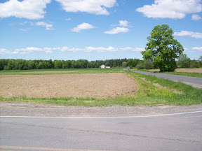
My trip to Moravia goes north on Route 34 out of Ithaca, alongside Cayuga Lake, up until Asbury Rd, where I turn right (east). Asbury follows Asbury Creek. I then turn north and head up Benson and then Van Ostrand Roads. Van Ostrand goes through slightly rolling farmland, with some forested areas, deadending at North Lansing School Rd (intersection shown in photo on right).

Then a quick right onto Breed, which hits Creek Road. Creek follows Locke Creek, in a valley, until it hits Rt 90, which takes you into the village of Locke (named, as I just learned, after English political philospher John Locke).

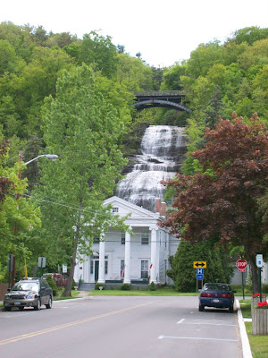
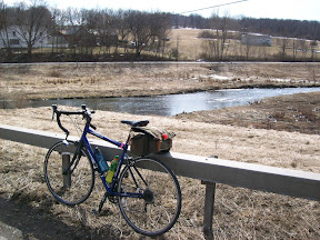
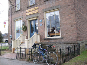
Turning north onto Rt 38, Moravia is just a few miles up the road from Locke. I've biked to or through Moravia a number of times, and always stop at a great little coffee shop, "Coffee 'n Cream." It's about 22 miles from home, so a good place to stop when I am doing my Owasco Lake ride. The photo at left is from a century ride I did in January that took me through Moravia.

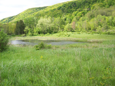
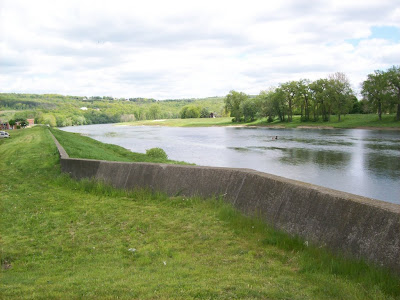
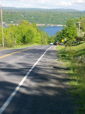
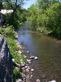
I had lunch at Coffee 'n Cream, and then turned back down Rt.38. This state route follows the Owasco inlet valley all the way past Groton. It's relatively level, though it is rolling in quite a few places. I passed back through Locke and kept going south, and eventually came to the village of Groton. Rt.38 turns a couple of times through Groton and then continues south. The Owasco Inlet valley eventually turns into wetlands, and then becomes part of the Fall Creek valley. Rt 38 hits Fall Creek at Freeville, and continues south through a deep valley toward Owego. (photo at right was taken from Rt 38 bridge over Fall Creek at Freeville, looking west).

On this ride, though, I turned back west onto Rt 366 at Freeville, and followed it out of town, turning right onto Upper Creek Rd. Rt 366 is very flat here. Following Upper Creek Rd and Lower Creek Rd, which go alongside Fall Creek, through rolling hills, past small hamlets, a goat farm and then after crossing Rt 13 into the Northeast area of Ithaca. Following Freeze Rd into Varna, then onto 366, onto Forest Home Dr and through Cornell campus back down into Ithaca.

The weather was beautiful, sunny, a bit cool (in the upper 50s). There was a stiff wind coming out of the north, so I was going into it for half the ride, probably 10-15 mph. This was the first time I'd ridden Rt 38 from Locke to Groton, and it's a nice ride, I'll definitely do it again. Very low traffic and pretty good shoulders.

Overall this is a great ride. It goes through lots of farmland, but also some forested areas. Moravia has a few places to eat besides the one I stopped at, including a pizza place, and Locke also has a diner. There's a great little ice cream stand in Freeville on Rt 38 just past 366 -- I was tempted to stop but decided to wait until next time.
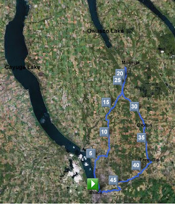
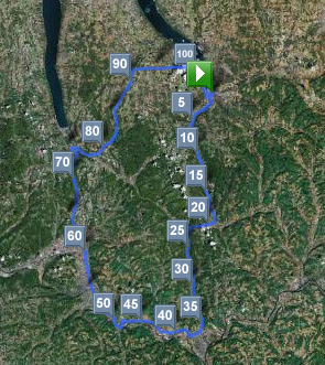
Route: Ithaca - N.Lansing - Moravia - Groton - Freeville - Ithaca
Total distance: 49.30 miles
Ride time: 3:12'34
Avg speed: 15.36 mph
Total climb: 1846 ft
Low point: 390 ft, Ithaca
High point: 1210 ft, Van Ostrand Rd near Goodman
Avg climb: 37.44 ft/mile
Consumed: 1 liter water, 24 oz orange juice, small coffee, turkey, lettuce and tomato sandwich on rye with mustard.

Saturday, May 24, 2008

May 2008 century ride

I've been doing a century a month since my first century ride in September 2007. The only month I've missed so far is December.

For May, I planned a trip south, along a route that is relatively flat: total climb average was 31.02 ft/mile. It went from Ithaca to Spencer to Waverly to Elmira to Montour Falls. From Montour Falls I'd planned to go to Burdett, but I missed the turn, so I ended up going to Odessa, then to Mecklenburg, Perry City and then back into Ithaca on Rt 89. See the satellite image at right for the route I actually rode. It goes by two of the Finger Lakes, Seneca and Cayuga, plus the small Cayuta Lake. It also follows the Susquehanna River from Waverly to Elmira.

It was a nice day for a ride, temp mostly in the lower 60s. There was a stiff, 10-20mph headwind coming out of the west and north, so the westbound and northbound parts were into that wind.


Fields along Rt 34/96 between Ithaca and Spencer
Coming out of Ithaca I followed Route 96/34 -- the only tricky part is cutting across Rt 13 where the two routes split. The ride to Spencer is a pretty gradual uphill, climbing 1057 ft over the 18 miles, though almost all of that climb is done by a few miles outside of Spencer. This section is rolling hills, beautiful landscape. You're essentially riding between two big hills: on the right is the hill between 34/96 and Rt 13, Newfield; on the left is the hill between 34/96 and Rt 96b, Danby. The route essentially follows Cayuga inlet and the old Lehigh Valley train tracks.

In Spencer, I turned right to continue along Rt 34 into Van Etten. Then, I continued along Rt 34 by turning south (left) in Van Etten. After the slight uphill climb out of Van Etten, the road is pretty much flat all the way to Waverly. The route goes right alongside Cayuta Creek most of the 15 mile ride. In Waverly it bears right to follow Chemung St to the end. You turn left to follow the signs towards Rt 17, but you take a right turn onto the road just before the highway. This is River Rd, a very scenic one lane road with bike path that follows right alongside the Susquehanna.

At the end of River Rd you turn right, go underneath a small, low overpass, and then turn left onto Rt 60 which you follow into the hamlet of Lowman; you'll know you're there when you see a number of 19th century houses with the names of various Lowman family members and the Lowman school. Turn left to cross over the river and highway; you also pass through what must be a wetlands area that is sometimes closed, given the big gates.

Once across, you turn right onto Rt 427 and you are in Wellsburg. There's a great diner, the Wellsburg Diner, on your left across from the fire station (thanks for the tip, Denny!). For me it was the perfect stopping spot for lunch, it came at mile 48 and I was feeling somewhat hungry. I got a bacon cheeseburger, a pepsi, water, a very large delicious and sugary cinnamon bun, and a coffee.


The Susquehanna River in Elmira
Then it was off to Elmira. Following Maple Ave through neighborhoods in Elmira, crossing the Susquehanna at Sly St, which turns into Madison.

This is also following NYS Bike Route 14: continue along Madison which eventually turns into Lake St. Follow Lake St through Horseheads and continue on Rt 14 north, part of the way along Catherine Creek.

Rt 14 was under construction outside of Montour Falls, so traffic was down to one lane, and it was backed up. I biked to the front of the line, and when we got the go-ahead, started pedalling. The first few cars went ahead, and I pulled into the lane when it narrowed. Behind me was a truck. By this time I was pretty tired, but I pumped and did 20mph for the 1/4 mile single lane.


The Chequaga Falls in Montour Falls
In Montour Falls I turned left on Main St hoping to find an ice cream place. No luck, but I did get to see the Chequaga Water Falls. I'm a bit nostalgic about this place, as my son was born here a bit more than 14 years ago. The birthing center is on a hill and has a beautiful view of Seneca Lake. It wasn't on my route though and I had enough of a climb out of Montour Falls that I decided not to do two of them.

Montour Falls is at elevation of about 450 feet. I'd planned to head to Burdett, elevation 1000 feet. I headed back down Main St, turned back onto Rt 14 North, and then right onto Clawson. Before me was Rt 224, a hill that climbed 550 ft -- from 450 ft elevation to 1000 ft elevation -- in about 2 miles, an avg of 7 percent grade. My commute to work has a 530 ft climb over a bit more than a mile, so this wasn't too bad. I was planning to turn onto Skyline Drive, but I didn't see a sign for it and continued up the hill. Turns out, the road off of 224 is not called Skyline Drive, but rather L'Hommedieu Rd, which turns into Skyline (thanks googlemaps...).

I had my suspicions about this halfway up, so stopped near the top of the hill to check the map and confirm that yes indeed I had missed the turn. Instead of turning back, I decided to plot an alternate course, which would involve more climbing -- up to a top altitude of 1450 ft instead of 1200 if I'd gone via Skyline Drive to Burdett.

This alternate course took me to Odessa, where I turned left (north) onto Rt 228. This route is not steep, but rises from 1100 feet at Odessa to about 1450 feet on the west side of Cayuta Lake. It then gently descends to about 1200 feet at Mecklenburg. I continued along 228 to Perry City, which is really not much more than a crossroads with a few buildings -- not sure how it got the name "city". Then, right onto Perry City Rd, for a bit of a hilly ride. Once you cross Rt 96 though, it's pretty much all downhill to Rt 89. As you approach 89 you get a great view of the hillsides of Cayuga Lake, and then a direct view of the Lake (see photo below).

The rest of the ride into Ithaca was pretty much downhill, and I lucked out with traffic lights, getting only one red light. Total distance turned out to be 104.91 miles, with an average speed of 15.08 mph. I actually did pretty well, well above 15mph on pretty much every leg -- the Spencer Waverly 18 miles was at 17.88 mph. The one that killed me was the Montour Falls to Perry City climb, averaging 64.41 ft/mile over 16.83 miles, for an average speed of only 12.14 mph.

Overall this was a great century ride, my fastest to date, and my second least-hilly. On the stretch between Odessa and Mecklenburg -- which at the time I didn't realize was uphill -- I started to feel a bit down, and I also felt a bit discouraged in some of the windier parts of the ride, between Waverly and Elmira and Elmira and Montour Falls. But I felt great by the time I was cruising back downhill into Ithaca.

I'll definitely do this ride again, though next time I'll take the turn for Skyline Drive to Burdett.
Route: Ithaca-Spencer-Waverly-Elmira-Montour Falls-Odessa-Mecklenburg-Perry City-Ithaca
Total distance: 104.91 miles
Ride time: 6:57'17
Avg speed: 15.08 mph
Total time: 9:40am-6pm, 8 hrs, 20 mins
Total climb: 3254 ft
Low point: 390 ft, Ithaca
High point: 1429 ft, Rt 228 west of north end of Cayuta Lake
Avg climb: 31.02 ft/mile
Consumed: 1 bacon cheeseburger, one large cinnamon bun, three or four granola bars, 32 ounces of Gatoraid, a few liters of water, one pepsi, one coffee.

Thursday, May 22, 2008

First post

If you've ever biked in the Finger Lakes region of upstate New York, you'll know what I'm talking about.

For those of you who haven't had the pleasure of doing so, this blog will give you an idea of this excellent biking region.

Why excellent?

First, we're located in upstate New York, where pretty much all state highways -- at least all relatively new ones -- have wide, paved shoulders. I never appreciated our shoulders until I took my bike down to Pennsylvania one weekend and found no shoulder at all.


Second, the population density isn't too high, so most state highways aren't too heavily trafficked, and there are plenty of country roads with virtually no traffic that will get you where you want to go.

Third, the beauty of the region. I've travelled to a lot of places in the US and abroad, and I don't think it's just my local bias when I say this is one of the most beautiful places. The rolling hills, the lakes, the waterfalls, all add up to a really great biking experience.

Yeah, there are some downsides. Winter is long, and it can be cloudy. But still...

Why the blog? Just a place to share routes and thoughts and photos of the biking I'm doing in the region. I've been bike-commuting for years, but just last year bought a road bike and started exploring this area. While I've driven a lot around here, biking really does bring you closer to the land, and it's made me appreciate this area.

So that's it for first post. Now, onward...